Good morning, Idaho!
We've got another sunny and warm day ahead, with afternoon temperatures climbing into the mid- to upper 80s.
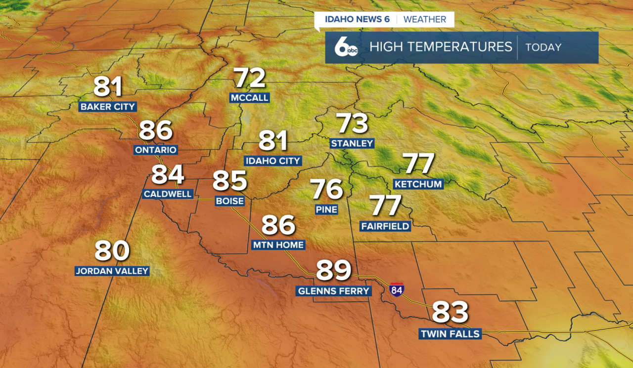
A few isolated thunderstorms are still possible later today and this evening, mainly near the Idaho-Nevada border south of I-84. The same pattern is expected on Friday, while most of southwest Idaho remains dry.

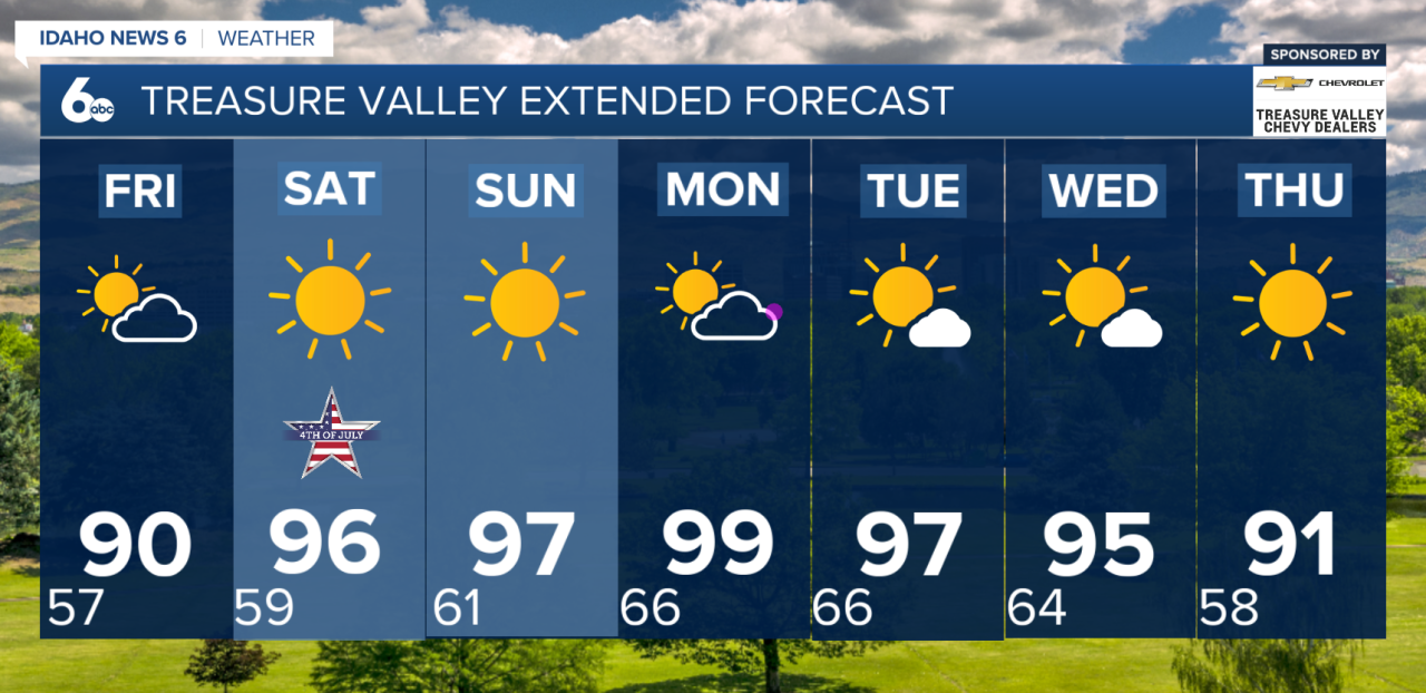
The bigger story is the warming trend. High temperatures in the lower valleys will rise from the 80s today into the 90s by Saturday, while humidity levels continue to drop, creating very dry conditions. The good news for Fourth of July plans is that the forecast remains quiet, with plenty of sunshine and no widespread storm concerns. If you're celebrating with fireworks, be sure to use extra caution, as the combination of heat and dry vegetation can increase fire danger.
The heat continues to build into next week, with highs reaching the mid to upper 90s Sunday through Tuesday. While this isn't expected to be extreme heat, it will be hot enough to create moderate heat-related impacts, especially for those spending long periods outdoors.
Looking ahead, a slight chance of thunderstorms returns Monday through Wednesday as monsoonal moisture begins moving north into the region. Breezy afternoon winds are also expected to develop early next week, particularly across southern Idaho.
Check out my Instagram here