Happy Hump Day, Idaho!
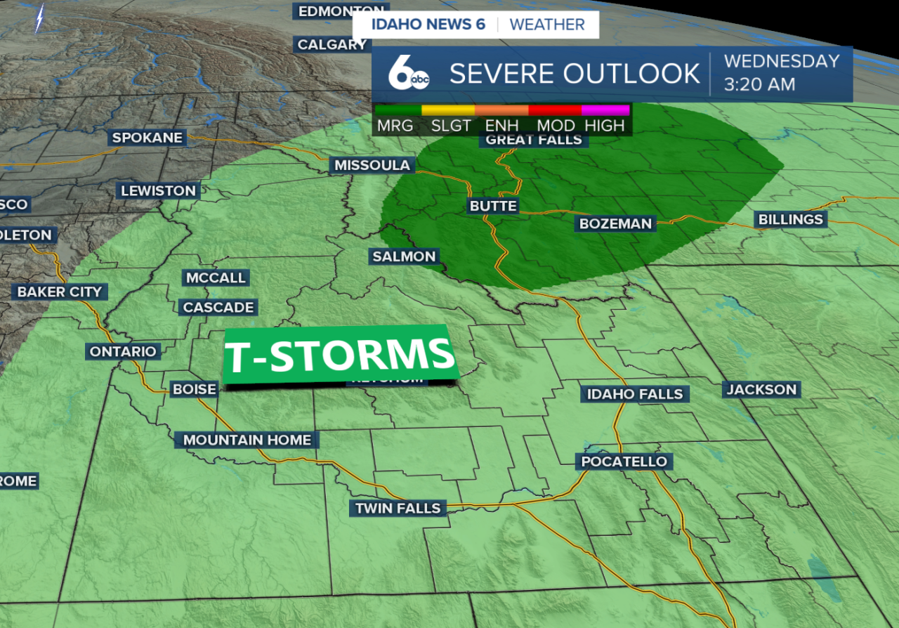
A few showers are moving through parts of the Treasure Valley this morning, producing brief flashes of lightning and thunder before fading later in the morning. Isolated showers and thunderstorm chances continue into the afternoon across southern Idaho, with the best chance for storms stretching from the western Magic Valley into the central Idaho mountains. Some stronger storms could produce brief gusty winds up to 50 mph.
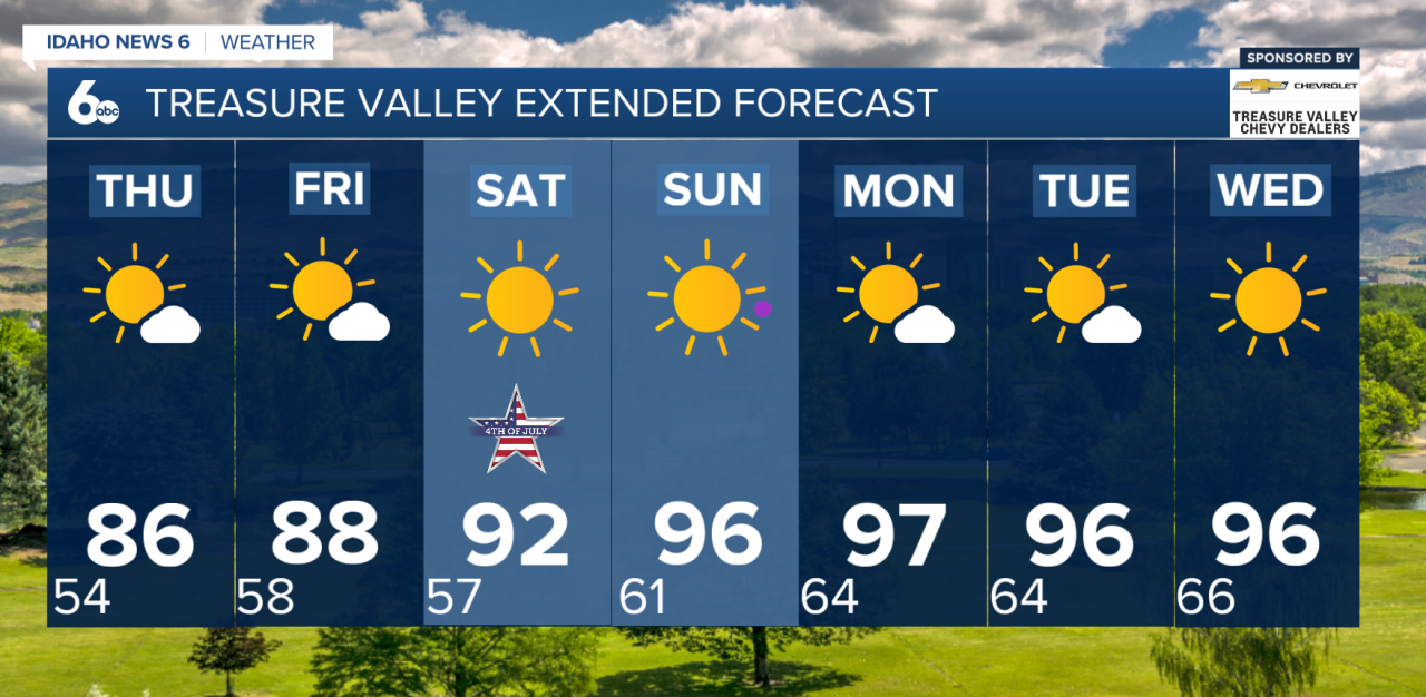
Storm chances decrease Thursday and become mainly confined to areas near the Idaho-Nevada border. After that, a drier and hotter pattern takes hold heading into the Fourth of July weekend.

Temperatures will gradually climb through the rest of the week, reaching the mid-80s Thursday and upper 80s by Friday, which is right around average for early July. Dry conditions continue through the holiday weekend with plenty of sunshine expected for Independence Day celebrations.
Looking ahead to early next week, temperatures will continue warming as high pressure strengthens across the western U.S. Monday is shaping up to be the hottest day, with many lower-elevation communities pushing into the 90s and a few spots potentially nearing 100 degrees. Overall, the forecast remains mostly dry through early next week, with only limited chances of mountain showers returning by Tuesday.