Happy Friday, everyone!
Hot and dry weather is settling in for the holiday weekend, with only a few isolated thunderstorms possible south of Twin Falls this afternoon. Any storms that develop will be weak but could still produce gusty outflow winds up to 35 mph.
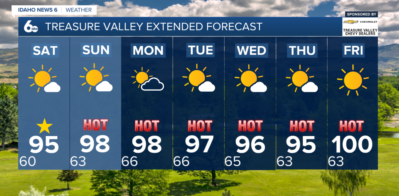
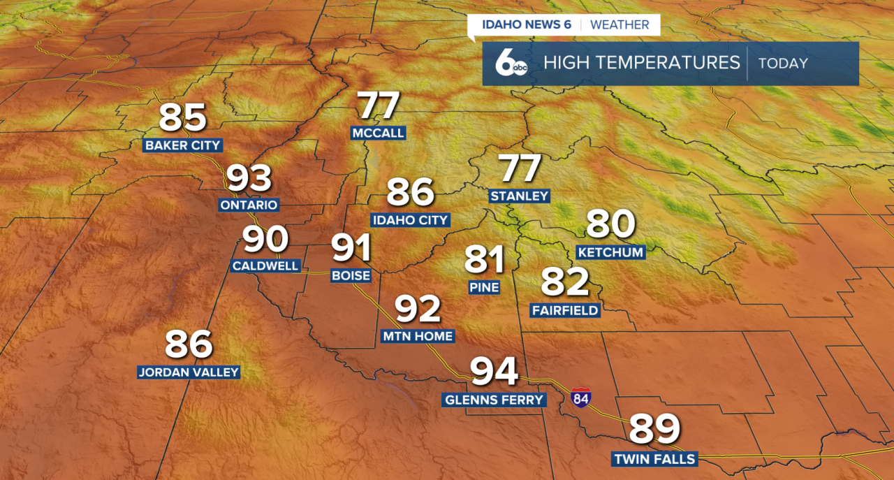
The bigger story is the heat. High pressure will continue building over the western U.S., bringing plenty of sunshine and a steady warming trend through early next week. High temperatures across the Treasure Valley will climb into the 90s this weekend, with some lower valley locations nearing the upper 90s by Monday and Tuesday.
The Fourth of July looks quiet across southwest Idaho, with hot, dry conditions and no widespread storm concerns. If you're heading outdoors for celebrations, be sure to stay hydrated and practice fire safety, as dry vegetation and warm temperatures can increase fire danger.

A slight chance of thunderstorms returns Sunday afternoon, mainly across the central Idaho mountains and parts of south-central Oregon. Storm chances expand Monday as monsoonal moisture begins moving north into the region. Any storms that develop will likely be high-based, meaning lightning and gusty outflow winds could occur even with limited rainfall.
By Tuesday and Wednesday, storm chances become more confined to central and south-central Idaho, while southwest Idaho remains mostly hot and dry. Temperatures will stay well above normal through midweek, with breezy afternoon winds developing each day.
Enjoy the holiday weekend, and stay hydrated through the heat.