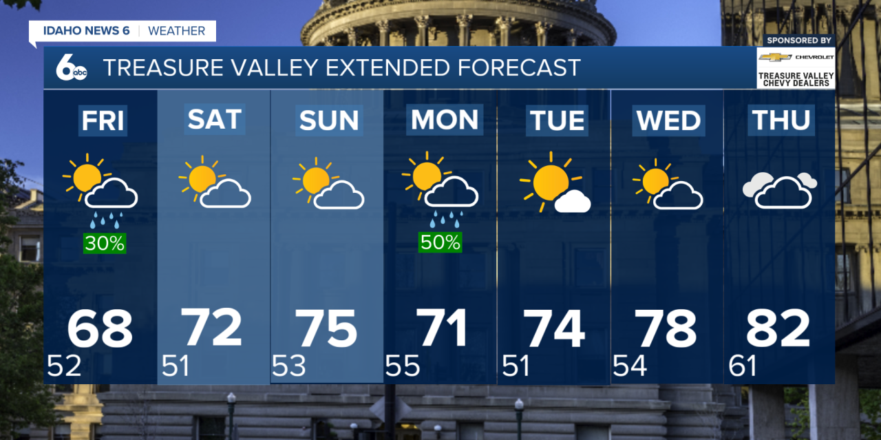
Thursday will be a wet and much cooler day across southwest Idaho as a large storm system remains parked off the Pacific Northwest coast.
Widespread rain will continue through the first part of Thursday, with embedded thunderstorms possible at times. As one disturbance moves away from the region Thursday afternoon, the rain will become more scattered, potentially allowing for a few breaks in the clouds.
However, another round of widespread rain arrives Thursday night as a cold front moves through. The front could also bring embedded thunderstorms and an increase in westerly winds.
Heavy rainfall remains one of the biggest concerns through Friday. Mountain locations could receive 1 to 1.5 inches of rain, with locally higher amounts possible underneath stronger storms. Recent burn scars across southeast Oregon and the central Idaho mountains will be especially vulnerable to flash flooding, including the Wapiti burn scar.
Flash Flood Watch
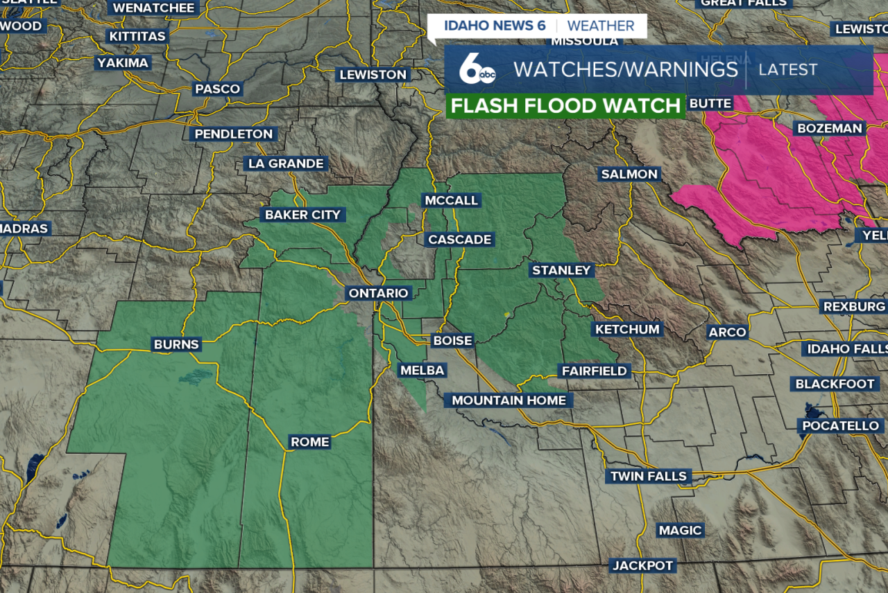
A Flash Flood Watch is in effect for portions of southwest Idaho from Thursday afternoon through Friday evening. Periods of heavy rain and thunderstorms could lead to flash flooding, especially near recent burn scars and other flood-prone areas.
The Weekend
Temperatures will also take a noticeable hit Thursday and Friday. Highs will run around 10 to 20 degrees below normal, with some locations potentially experiencing record-cold daytime temperatures.
The cold front moves through early Friday, allowing for some clearing during the morning. A little sunshine could then help fuel another round of isolated to scattered thunderstorms Friday afternoon.
Rain chances decrease somewhat Saturday as temperatures begin to recover closer to normal. However, the break won't last long. The large storm system will move inland Sunday, bringing another increase in showers late Sunday into Monday.
Treasure Valley Extended Forecast