Good morning, Idaho!
Monsoonal moisture is bringing a much more active weather pattern to southwest Idaho and eastern Oregon today. Showers are already moving through parts of the region this morning, with additional rounds of rain and thunderstorms expected this afternoon and evening.
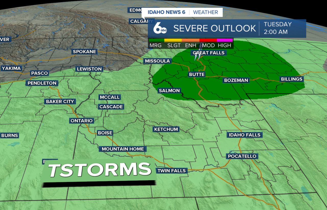
Some of the heaviest rain will fall across eastern Oregon, the Owyhee Mountains, and areas near the Nevada border. Because the atmosphere is holding plenty of moisture, some storms could produce brief heavy downpours that may lead to localized flooding, especially near burn scars and in poor drainage areas. Gusty outflow winds between 25 and 40 mph will also be possible with stronger storms.

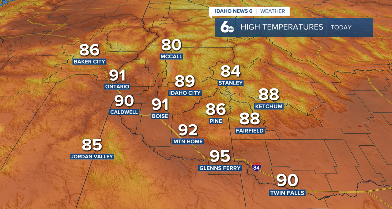
Cloud cover and rain will help keep temperatures a little cooler today compared to the recent stretch of heat. However, the cooler temperatures won't last long.
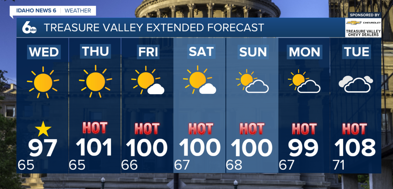
By Wednesday, much of the deeper moisture shifts east, allowing for more sunshine and a warming trend. A few isolated afternoon showers and thunderstorms will still be possible over the mountains, but most valley locations will stay drier. Temperatures will continue climbing through the second half of the week.
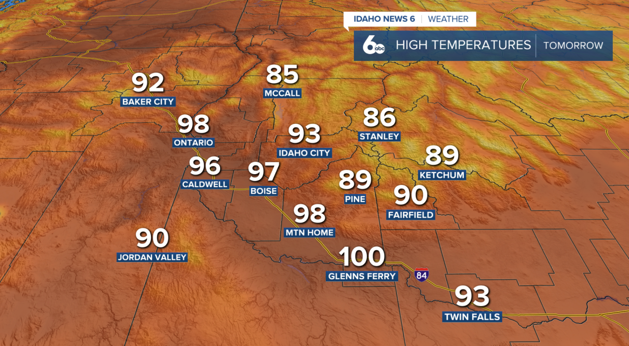
By Thursday, highs could once again reach or exceed 100 degrees across lower elevations, including parts of the Snake River Plain and Weiser Basin. Another push of monsoonal moisture may also increase storm chances later Thursday and into the weekend.
Looking ahead, hot temperatures remain the main story through the weekend, with daily chances for afternoon and evening thunderstorms continuing across portions of southwest Idaho. Anyone spending time outdoors should stay weather-aware for both heat and changing storm conditions.