Cheers to Friday, Idaho!
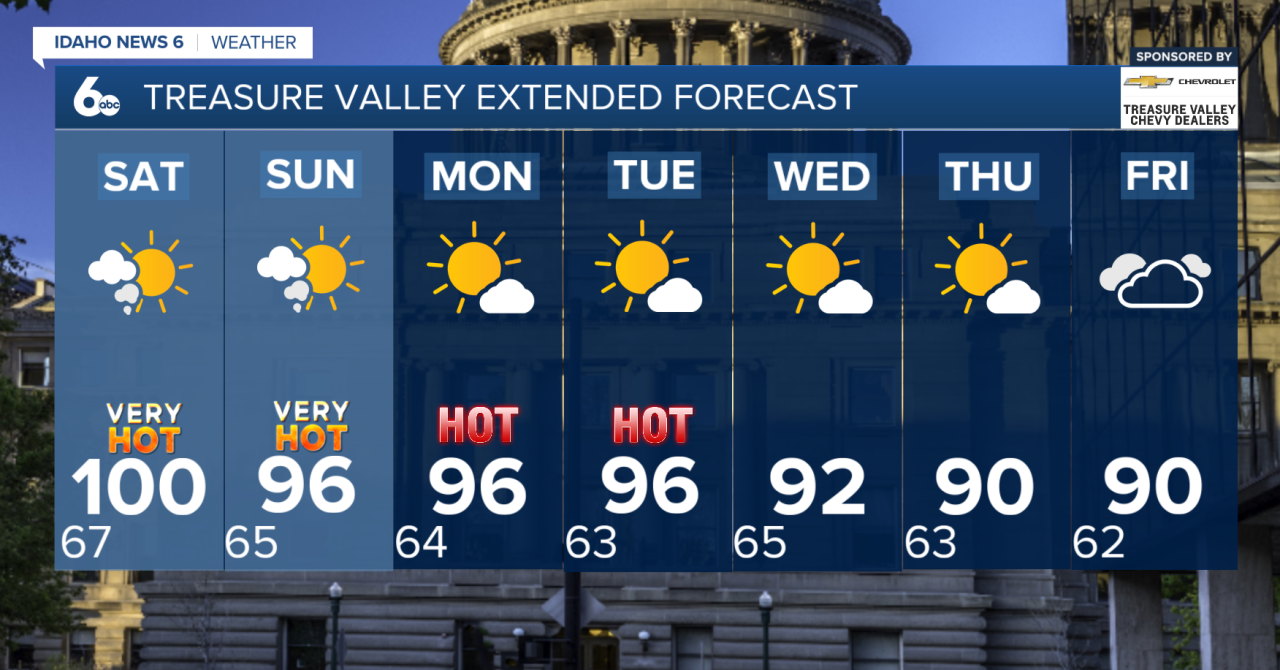
Hot temperatures, smoky skies, and breezy afternoons continue through the weekend. Highs today will climb into the triple digits across the Treasure Valley, making Friday the hottest day of the stretch.

Saturday stays very hot, though temperatures ease back by a couple of degrees. Even with the daytime heat, dry air will help temperatures cool into the 60s overnight.
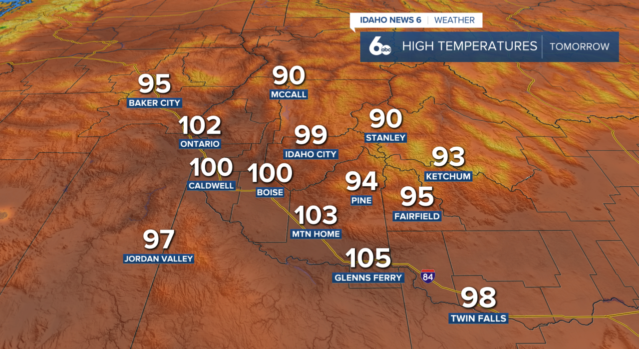
Wildfire smoke will continue to create hazy skies and poor air quality through at least Sunday. If you have plans outdoors, be sure to check the latest air quality conditions and consider limiting prolonged time outside if smoke becomes thick. Check the latest air quality conditions here
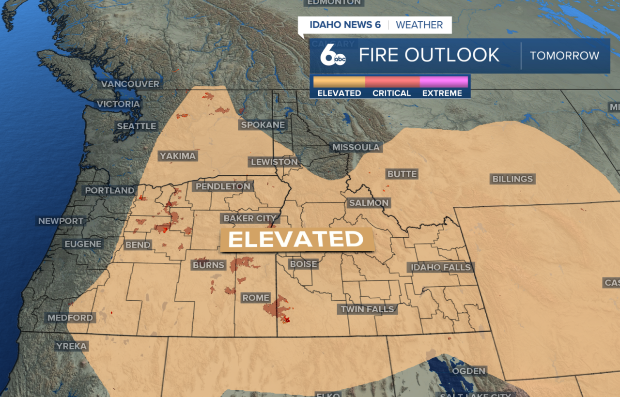
Saturday brings an elevated wildfire risk as breezy afternoon winds pick up across southwest Idaho. Wind gusts around 25 mph are expected, especially across the Snake Plain and southern parts of the region. With the hot, dry weather, it's a good idea to avoid outdoor burning this weekend since fires could spread quickly.
There is also a slight chance for a few high-based showers or thunderstorms near the Idaho-Nevada border Saturday and Sunday. Most areas will stay dry, but any storms that do develop could produce gusty, erratic winds even if little rainfall reaches the ground.
Warnings/advisories
A Heat Advisory remains in effect for southwest Idaho and extends into south-central Oregon through Saturday evening. If you'll be spending time outdoors, avoid strenuous activities during the hottest part of the day, stay hydrated, and listen to your body for signs of heat-related illness. If you're traveling this weekend, be aware that Red Flag Warnings are in effect across parts of northern Idaho, Oregon, and Washington. Avoid outdoor burning, as hot, dry, and windy conditions can allow fires to spread quickly.

Looking ahead
Looking ahead, a weak weather system will bring cooler temperatures beginning Sunday, with highs returning closer to average by Monday. Breezy afternoons are expected to continue into next week; we will continue to keep an eye on another possible surge of monsoon moisture that could increase thunderstorm chances by the middle of the week.