Today through Saturday Night
High pressure stays in control, which means a stubborn temperature inversion continues across the region. That’s keeping air stagnant in the valleys, with patchy fog and low clouds lingering in places like the Lower Treasure Valley, Western Magic Valley, and Long Valley this morning. Higher clouds overhead have helped limit how widespread the fog gets, but it’s still popping up in spots! Just a reminder to turn on your low beams where visibility starts to get difficult.
A weak disturbance passing north of us today could bring a few light snow showers to Baker County and Idaho’s West Central Mountains — but most areas stay dry (hug your snow-loving friends)
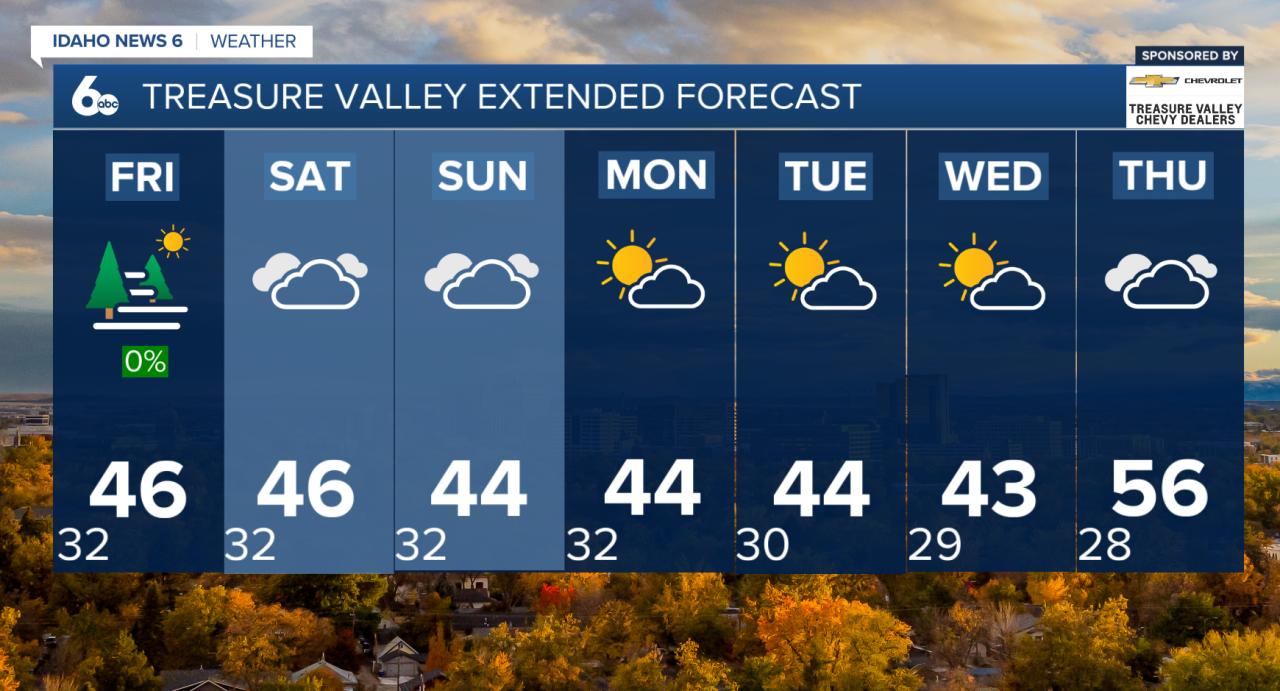
Looking ahead to Friday and Saturday, the ridge strengthens even more. That keeps dry weather locked in, but also makes fog, low clouds, and temperatures tricky to forecast in the valleys. Mountains stay well above normal, while valley locations remain stuck in the 30s to low 40s under cloud cover. Either way, no major changes expected through the start of the weekend.
Long Term: Sunday through Thursday
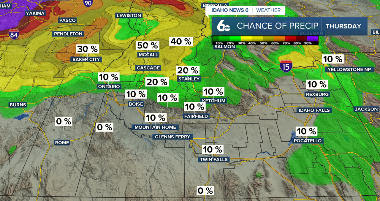
On Sunday, winds shift out of the southwest as a weak system approaches. Breezier conditions develop Sunday afternoon, especially across southern areas. That system weakens as it arrives, leaving just a 10–20% chance of light snow for the mountains of northeast Oregon and west-central Idaho late Sunday into early Monday. Snow levels dip to around 4,500–5,500 feet, with little accumulation expected.
A weak cold front Monday brings cooler air and breezy northwest winds, but temperatures stay above normal. After that, strong high pressure rebuilds and dominates the rest of the week.
Week ahead:
- Dry weather
- Another round of valley inversions
- Fog, low clouds, and stagnant air likely returning