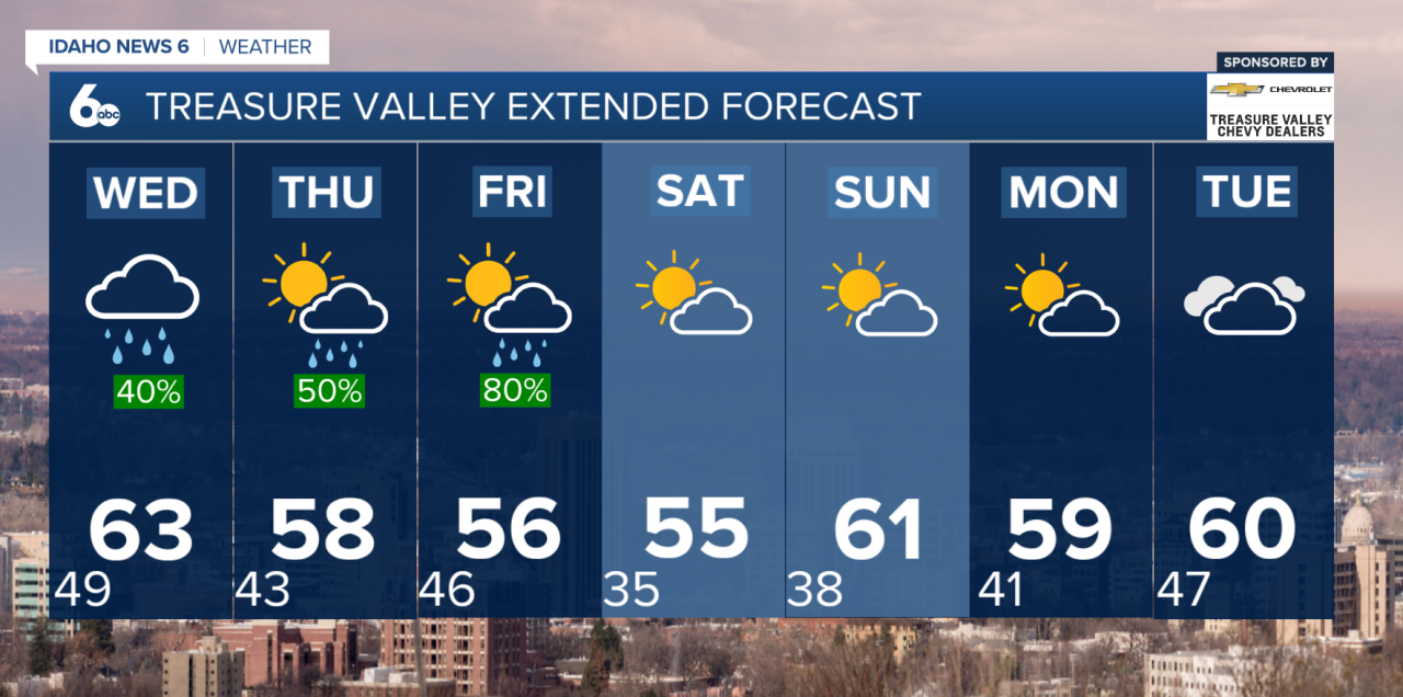


Good Morning, Idaho! A series of storms this week equates to shower chances through Friday. Pack the Umbrella for the week ahead.
Storm #1 today
A weak front and upper trough kicked off this morning with scattered showers, mainly in the Boise Mountains. The front will stall by mid-morning, keeping light showers over the higher terrain before drifting north later in the day. Some light rain could reach parts of the Snake Plain, but most valley locations will stay mostly cloudy and breezy.
What to expect:
- Light showers, mainly over the mountains
- Little to no accumulation in the valleys
- Mild temperatures with increasing clouds by afternoon

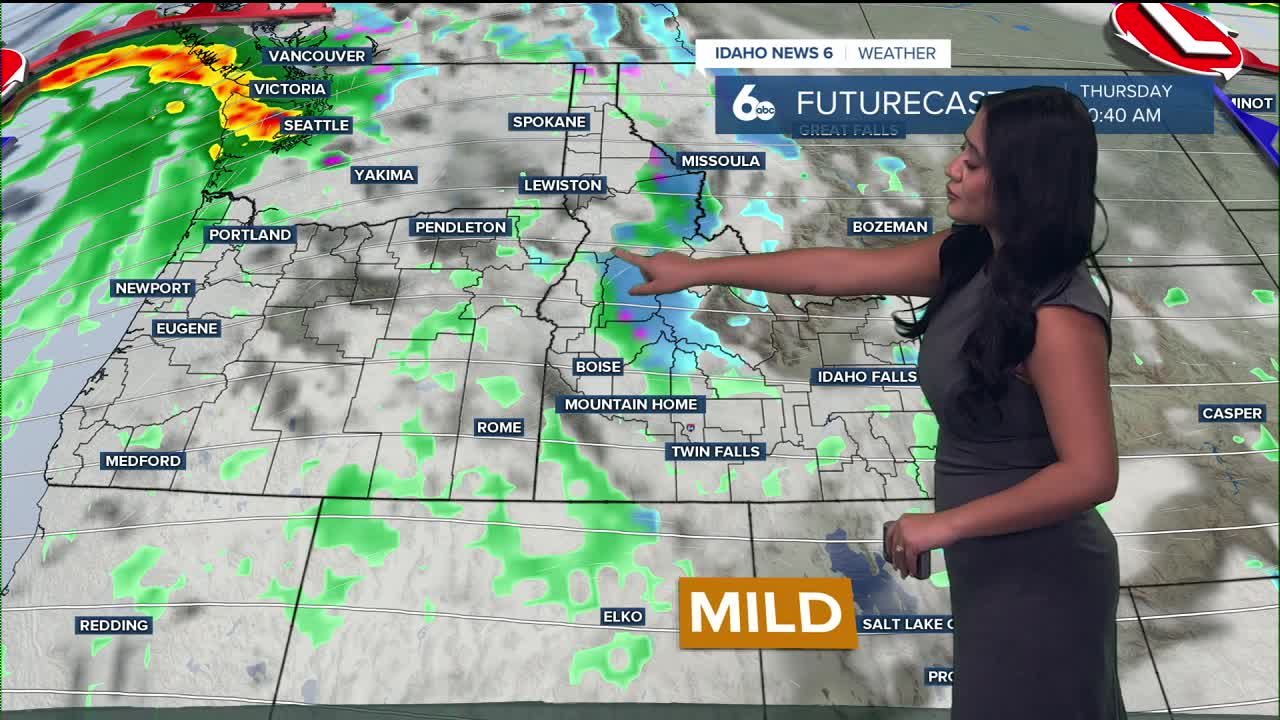
Storm #2 arrives Tuesday night
A deeper Pacific trough arrives late tonight and will bring showers into the region Wednesday morning, along with gusty winds and widespread mountain precipitation. Winds will strengthen across southwest Idaho — gusts could top 40–50 mph in exposed areas.
Snow levels start around 7,000–8,000 feet and drop to near 6,000 feet by Thursday morning. Most higher elevations can expect 1–3 inches of snow, with up to 6 inches on the tallest peaks.
Rain and snow totals:
- Valleys: generally under 0.10"
- Mountain valleys: 0.25–0.50"
- Peaks: up to 0.75" liquid equivalent
Showers taper through Thursday as the storm moves east, but lingering light mountain snow will continue through the morning.
Storm #3 arrives Friday
Hot on its heels, another Pacific system sweeps through early Friday. It’s a quick hitter but brings one more dose of moisture and wind. The strongest impacts will again be in the west-central and central Idaho mountains, where upslope flow will squeeze out additional inches of snow above 6,000–7,000 feet.
Valley areas may see spotty rain, but strong mid-level winds will create rain-shadow effects, keeping totals low. Temperatures dip slightly yet remain close to average for early November.
Friday highlights:
- Quick burst of mountain snow
- Breezy to windy conditions behind the cold front
- Temperatures near normal
Weekend
By Saturday, high pressure builds back in, bringing a return to calmer, drier conditions. Morning fog may develop in the valleys, but the weekend looks mostly sunny and mild.
Stay up to date right here https://www.instagram.com/sophiacruzwx/