Happy Hump Day!
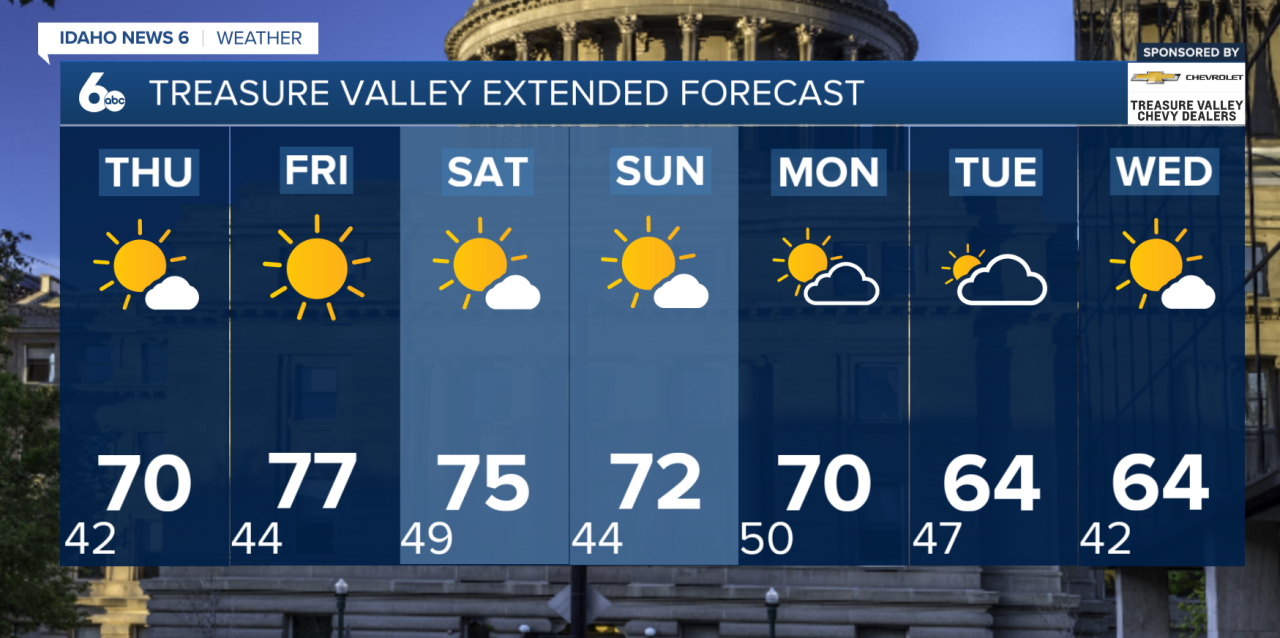
It's a chilly start to Wednesday across Southwest Idaho, but warmer fall afternoons are just around the corner! High pressure will bring sunshine and above-normal temperatures through the weekend before another potential cooldown arrives next week.
Today
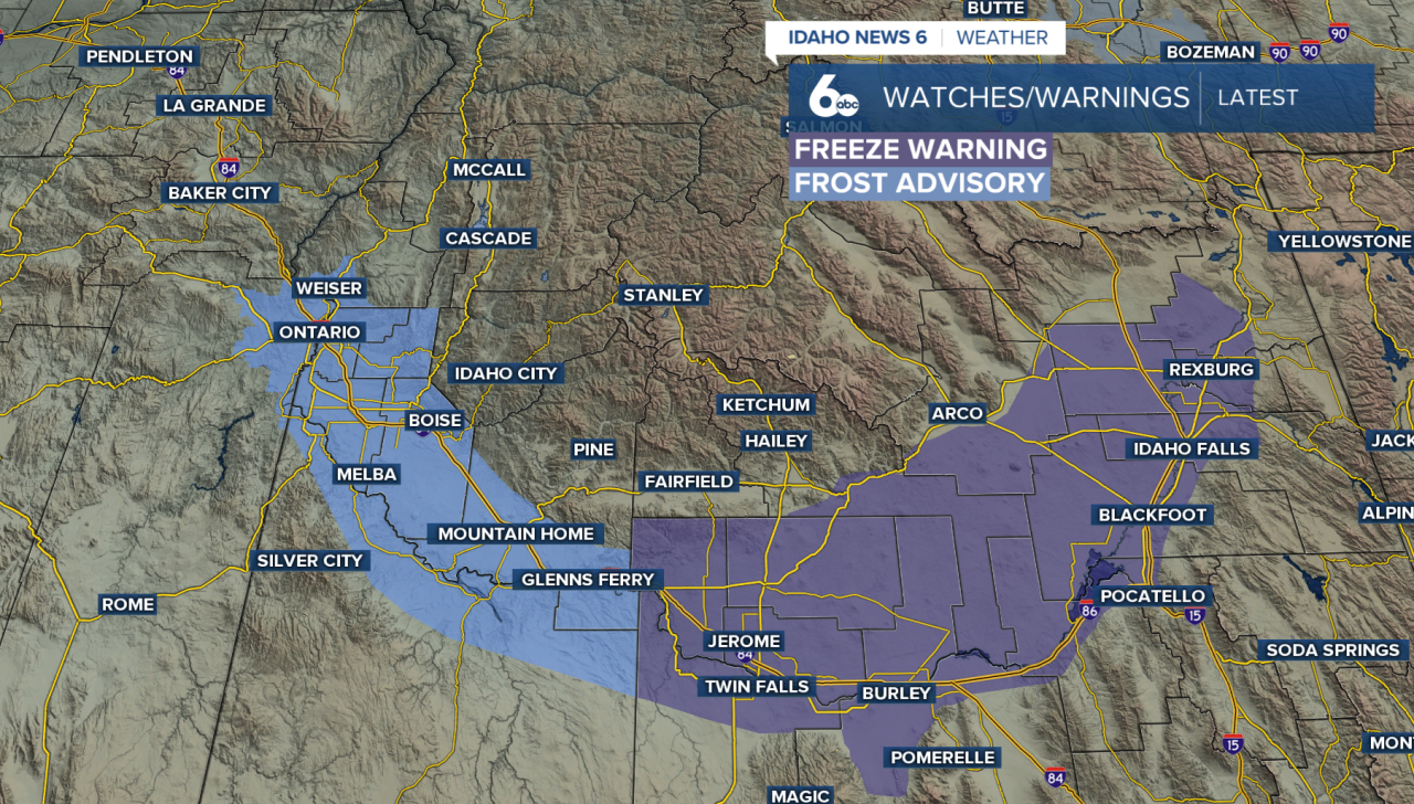
Temperatures are dipping into the lower to mid-30s across many valley locations, creating favorable conditions for frost. Frost Advisories remain in effect for portions of the Snake River Plain, while a Freeze Warning is in place for the Magic Valley through late morning. Protect any sensitive outdoor plants!
Wed-Fri
A strong area of high pressure will build across the Pacific Northwest, bringing dry skies and a gradual warming trend. Afternoon temperatures will climb several degrees each day, with Friday potentially reaching 15 degrees above average. Despite the warmer afternoons, chilly mornings will continue, with patchy frost and fog possible in sheltered valleys.
This weekend:
The warm and dry pattern continues Saturday, with temperatures running 10 to 15 degrees above normal. A weak, dry cold front will move through Sunday, knocking temperatures down a few degrees. However, highs will remain above seasonal averages.
Looking ahead:
Changes could be on the horizon! A Pacific storm system approaching from the Gulf of Alaska may bring cooler temperatures and renewed precipitation chances by Tuesday and Wednesday. There is still uncertainty surrounding the storm's exact track and timing, so details will become clearer over the coming days.
Extended Forecast