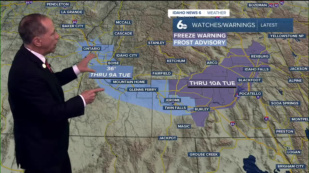


A chilly night is ahead for the entire area with temperatures dropping below freezing in higher elevations, and a Frost Advisory issued for the Treasure Valley for Tuesday morning. The best chances for frost will occur in areas outside of the Boise metro area and in normally colder valleys.
By the middle of the week, a steady warming trend will take hold. Afternoon highs are expected to climb about 5 degrees each day, eventually reaching the mid to upper 70s to even low 80s across the lower valleys.
Looking toward the weekend, a much more unsettled weather pattern is on the way. A large upper low off the coast will swing inland by Saturday, pulling in a broad plume of moisture tied in part to the remnants of Hurricane Priscilla. Rain chances increase as early as Friday afternoon, becoming more likely Saturday and Sunday.
Mountain locations have the best chance for heavier rainfall, with a 50-70% chance of seeing more than half an inch, while valley areas hold closer to a 10-30% chance.
Snow levels will start out high but drop to near 5,000-6,000 feet by Sunday, allowing for light mountain accumulations. McCall has a slight chance of a dusting of snow by Sunday morning. Temperatures will also cool sharply, with highs falling into the 50s by Sunday and Monday in the valley.

Stay updated on these changing weather conditions and find the complete
ScottScore extended weekend forecast on my Facebook page.

Saturday
A 40 percent chance of showers. Partly sunny & much cooler, with a high near 63.
Saturday Night
A 30 percent chance of showers. Mostly cloudy, with a low around 42.
Sunday
A 30 percent chance of showers. Mostly sunny and unseasonably cool, with a high near 55.

Sunday Night
A 20 percent chance of showers. Partly cloudy, with a low around 38.
Monday
Mostly sunny & continued very cool, with a high near 56.