

A warming and drying trend is taking over the region as weak high pressure builds in. Light southeast winds and increasing sunshine will help temperatures climb a few degrees above normal by midweek.
However, early this morning, light winds have allowed colder air to settle in the valleys—prompting a Freeze Warning for parts of the Snake River Plain. Boise and the foothills should stay just above freezing, but lower valleys like Caldwell and Ontario may dip into the upper 20s to low 30s before sunrise.

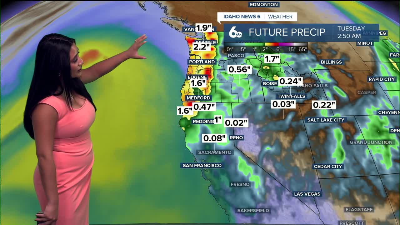
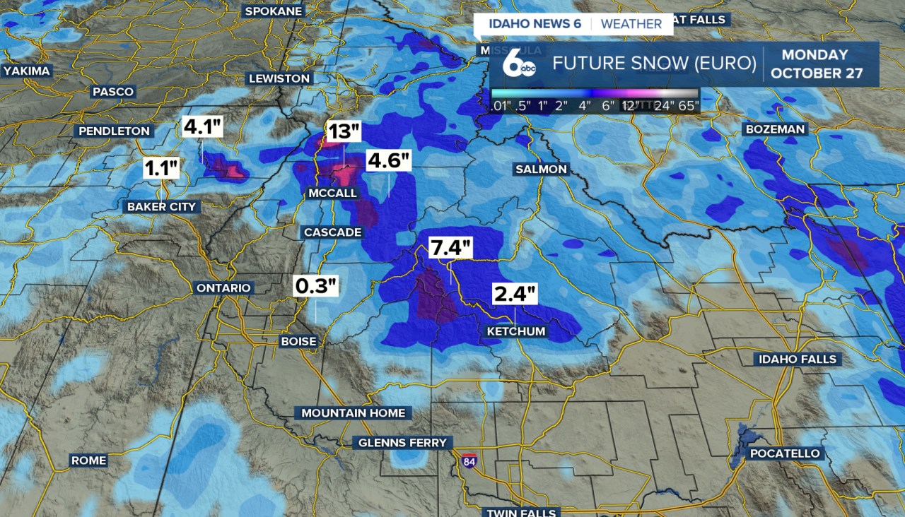
Looking ahead, a major pattern shift arrives late Friday as a deep trough over the Gulf of Alaska sends a plume of Pacific moisture into the Northwest. This atmospheric river will usher in widespread rain and mountain snow by early Saturday. Warm southwest flow ahead of the system will keep temperatures above normal Friday and Saturday, but a sharp cool-down follows on Sunday—dropping daytime highs by 10 to 15 degrees. Snow levels will fall from 7000–8000 feet Saturday to around 4000–5000 feet by Sunday and Monday, leading to heavy snow in the mountains, 8–12 inches at higher peaks, 1–3 inches in mountain valleys.
By late Monday, the system shifts east, leaving behind cool northwest flow and a few lingering mountain showers. High pressure is then expected to rebuild by Tuesday, bringing back sunshine and milder temperatures.
