

Good Morning Everyone!
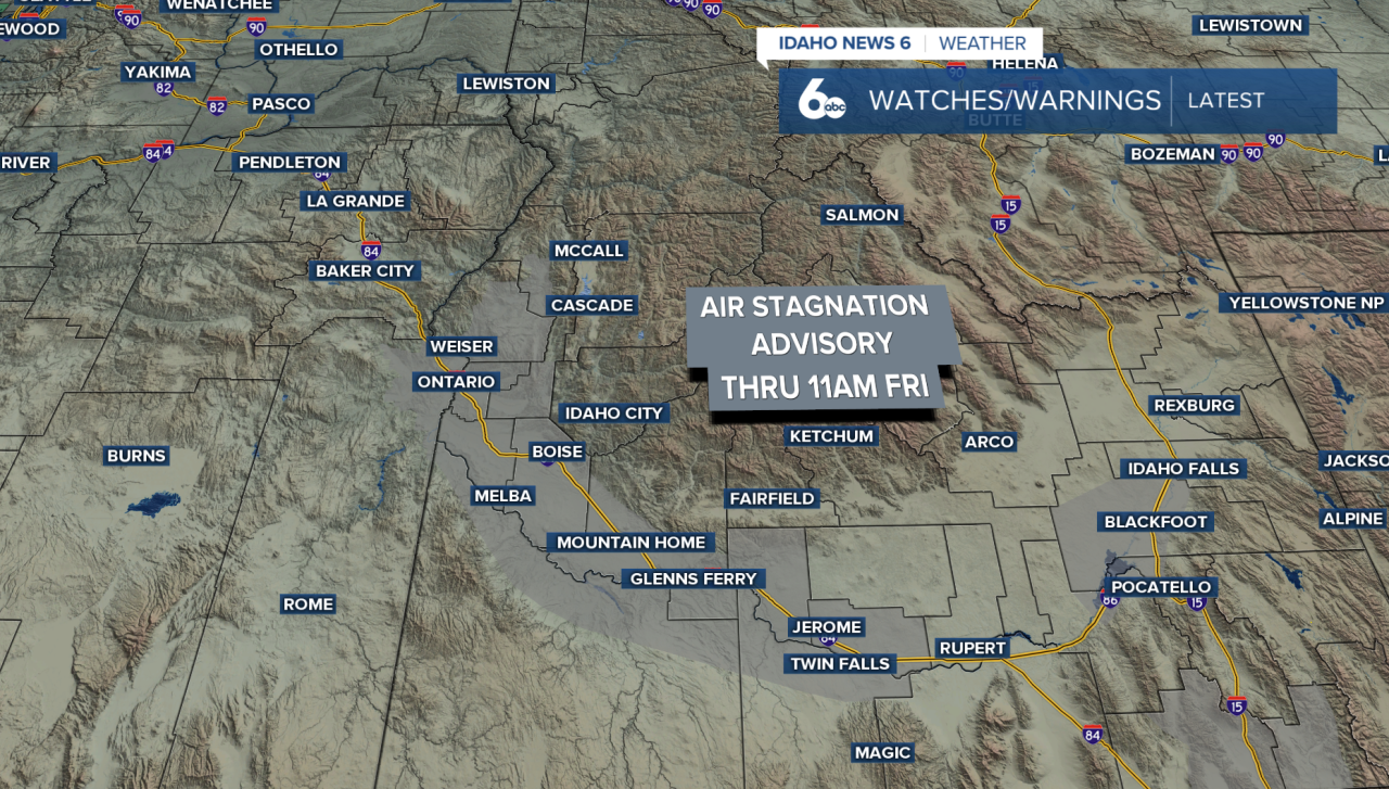
Skies have mostly cleared across the region, and that’s allowing fog to form across the East and West Central Mountains and into Eastern Oregon this morning. While visibility hasn’t dropped below a mile just yet, fog is expected to become more widespread over the next few days. High pressure overhead is strengthening a temperature inversion, trapping moisture and pollutants near the surface and keeping conditions stagnant. Therefore, an air stagnation advisory is in effect through 11 am Friday.
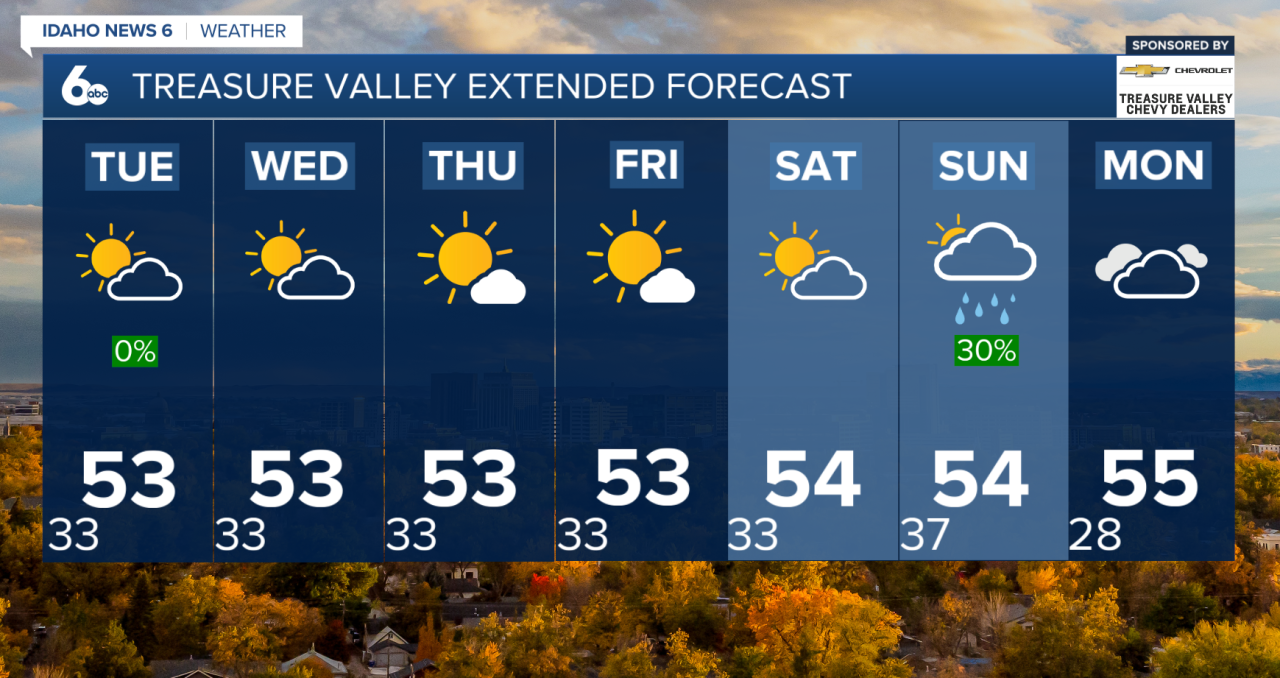
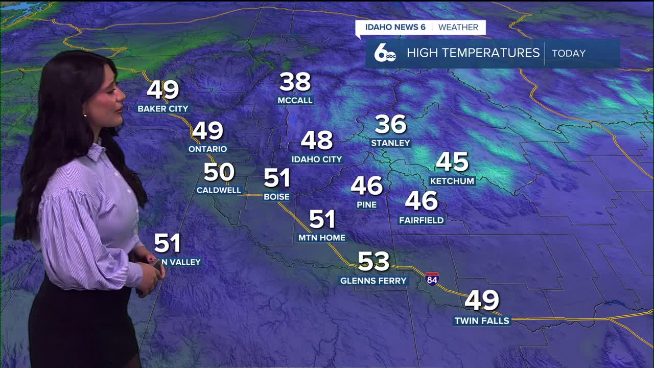
Morning fog will thin out during the day, turning into a light haze before reforming again at night. Valley locations that see fog will run cooler overnight as cold air settles in, while daytime temperatures remain fairly mild overall.
This fog-and-inversion pattern will stick around through midweek as a blocking pattern stays in place. Expect repeated rounds of morning fog, with limited mixing during the day. Higher elevations will stay drier, sunnier, and milder compared to the valleys.
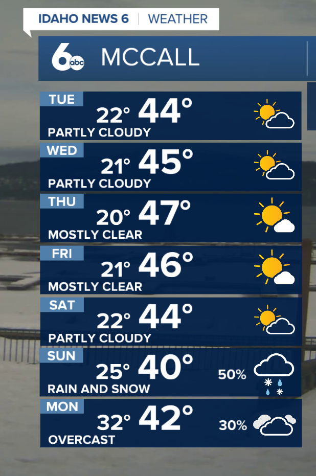
Looking ahead to late week and the weekend, changes are on the horizon. High pressure and stagnant air linger into Friday, but by Friday evening, the weather pattern begins to shift as the blocking system weakens. Forecast models show a return to a more active flow by Sunday into Monday, allowing moisture to move back into the region. This transition indicates increasing cloud cover, increased precipitation chances, and cooler temperatures across all elevations (snow dances continue!).