


An active weather pattern continues today before Idaho transitions back to dangerous heat and increasing fire weather concerns later this week.
WATCH: Weather Forecast for July 22 - Flash flood watch today before excessive heat returns
Today's biggest concern is the threat for heavy rainfall across central Idaho. The Weather Prediction Center has placed much of central Idaho under a Slight Risk (Level 2 of 4) for excessive rainfall, meaning scattered flash flooding is possible where the heaviest thunderstorms develop. Surrounding areas, including parts of southwest Idaho, are under a Marginal Risk (Level 1 of 4), where isolated flash flooding is possible. Numerous showers and thunderstorms are expected over the central Idaho mountains this afternoon, and storms will be capable of producing torrential rainfall, especially over burn scars, steep terrain, and in narrow canyons.

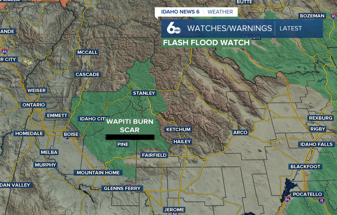
A Flash Flood Watch remains in effect through this evening for the Wapiti Burn area, where heavy rain could quickly lead to flash flooding and debris flows. Outside of the mountains, isolated to scattered thunderstorms are possible across southeast Oregon and southwest Idaho, with stronger storms capable of producing brief heavy rain and wind gusts up to 45 mph.
Smoke from regional wildfires will continue to impact air quality today, especially across east-central Oregon, west-central Idaho, and at times into the Treasure Valley.
By Thursday, storms become more isolated, but a few afternoon and evening thunderstorms are still expected across eastern Oregon and western Idaho. Some of those storms could make it into the Treasure Valley, bringing gusty winds and locally heavy rainfall.
The weather then shifts toward heat. Valley highs climb back above 100 degrees Thursday, with some communities approaching 105 degrees on Friday. At the same time, drier air and breezy southwest winds will increase fire weather concerns, especially across higher terrain. Thunderstorm chances become confined to south-central Idaho by Friday as much drier air moves into the region.
The weekend stays hot, dry, and breezy. Saturday looks to be the hottest day, with triple-digit temperatures continuing in the valleys. Winds and low humidity will keep wildfire concerns elevated before temperatures ease slightly into the mid-90s by Sunday and early next week. Dry weather is expected to continue.
If you're heading into the mountains today, have multiple ways to receive weather alerts, avoid camping near burn scars or creeks, and never drive across flooded roadways. Later this week, shift your focus to the heat and elevated fire danger as summer conditions return.

