Good Morning Idaho
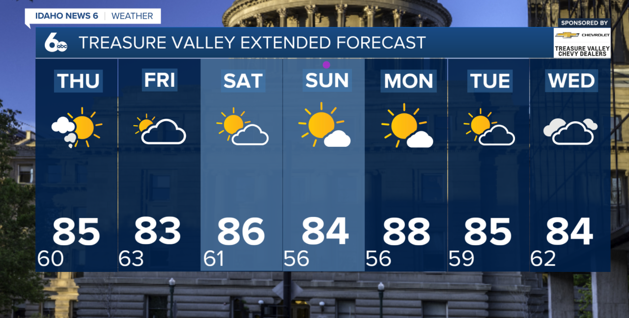
The main weather story this week is storm chances increasing heading into Friday, with heavier rain possible, followed by cooler temperatures this weekend.
Wednesday stays warm and mostly dry across the lower elevations, but isolated thunderstorms could develop during the afternoon, mainly over the central Idaho mountains and southern Twin Falls County. Any storms that form could produce gusty and erratic outflow winds up to 40 to 45 mph.
Thursday will bring a similar setup, with above-normal temperatures continuing and another chance for isolated afternoon thunderstorms. Breezy southwest winds are also expected across parts of eastern Oregon and the southwest Idaho highlands.
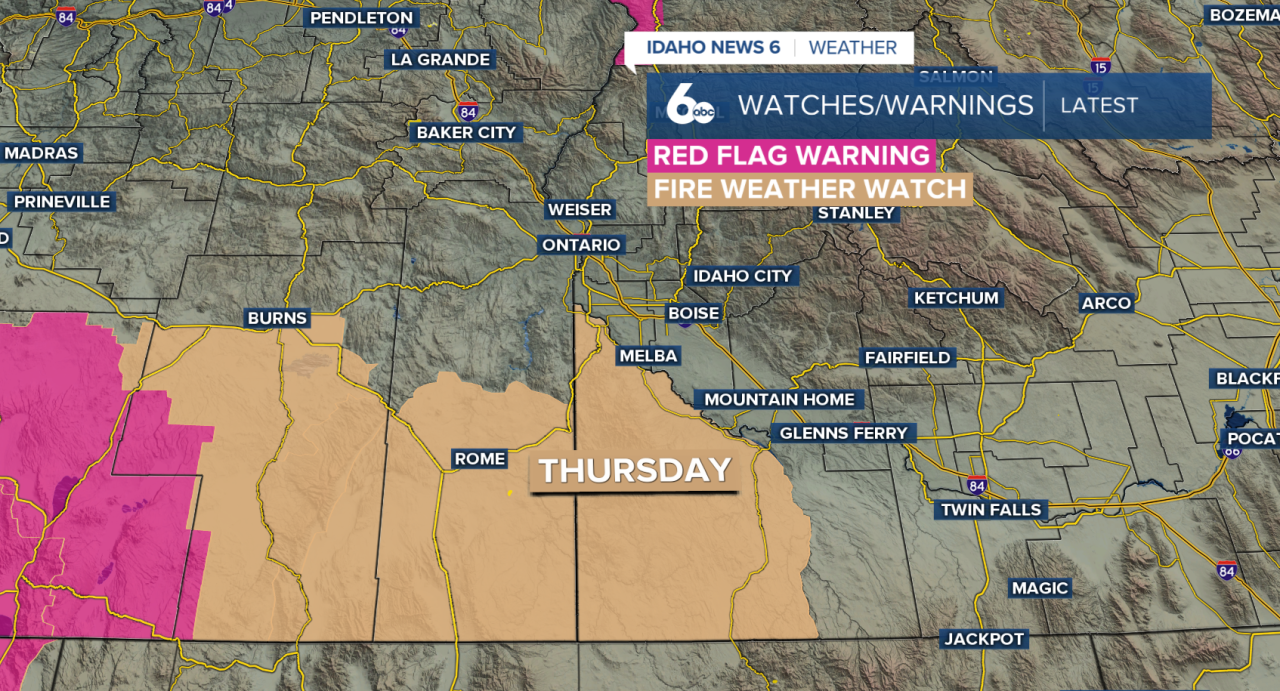
A Fire Weather Watch is in effect Thursday afternoon through Thursday evening for Owyhee County due to gusty winds and low humidity. Outdoor burning is not recommended, as any fires that start could grow and spread quickly.
By Friday, moisture from the remnants of Tropical Storm Iselle will move into the region, bringing a better chance for rain. Scattered showers and isolated thunderstorms are expected across southwest Idaho and eastern Oregon, with some areas potentially picking up more than a tenth of an inch of rain. Heavy rainfall will also be possible with stronger storms, especially across the southwest Idaho highlands, central Idaho mountains and southern Twin Falls County.
Showers and isolated thunderstorms could linger into Saturday before a dry cold front moves through. Temperatures will be near normal Saturday before dropping below normal Sunday.
Another cold front could bring another round of cooler weather by Tuesday and Wednesday.