Good morning, everyone!
Spring is serving up a little bit of everything this week — starting warm and windy before shifting to a wetter, more unsettled pattern heading into the weekend.
A weak, dry cold front moves through today, and while it won’t bring much rain, it will bring noticeable wind. Gusts between 20 and 35 mph are expected this afternoon and evening, which could make for difficult driving conditions, especially for high-profile vehicles on east-west roads. Loose outdoor items may also get tossed around, so it’s a good idea to secure anything lightweight.
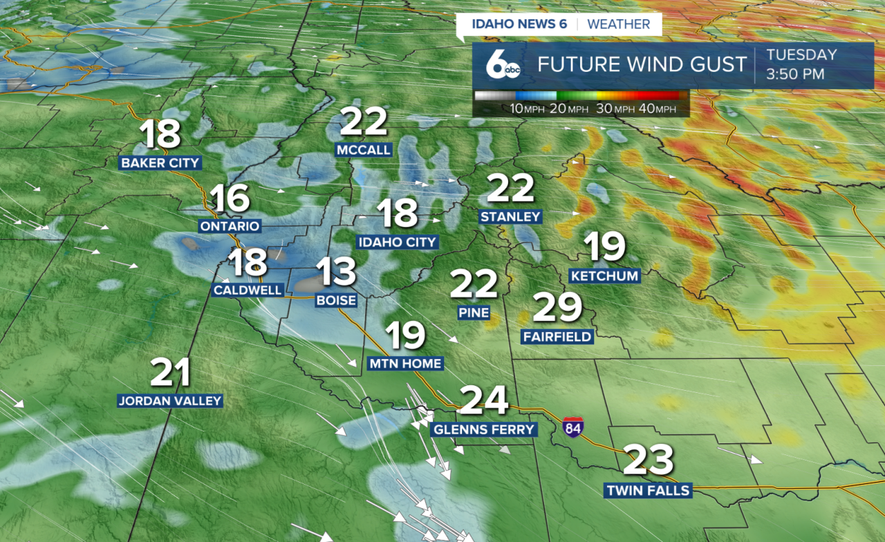
Valley floors will top out in the 70s and, combined with gusty winds, will feel cooler at times, making it feel more like the 60s. Overall, still a pleasant day ahead.
There’s also a small (around 20%) chance for an isolated shower or thunderstorm near the Idaho/Nevada border, but most areas will stay dry.
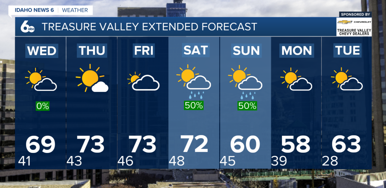
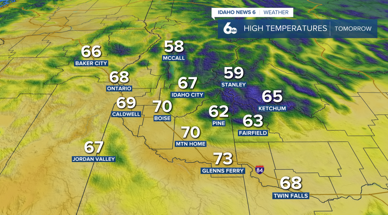
Temperatures remain warm, with southern valleys climbing into the low to mid 70s. Northern areas cool slightly today, with a more noticeable — but still mild — cooldown arriving for everyone by Wednesday.
Midweek: Slight Cooldown, Increasing Clouds
By Wednesday, temperatures dip about 5 degrees but remain above normal for early April. Winds will still be breezy in south-central Idaho, though not as strong as today.
More importantly, a shift in the pattern begins.
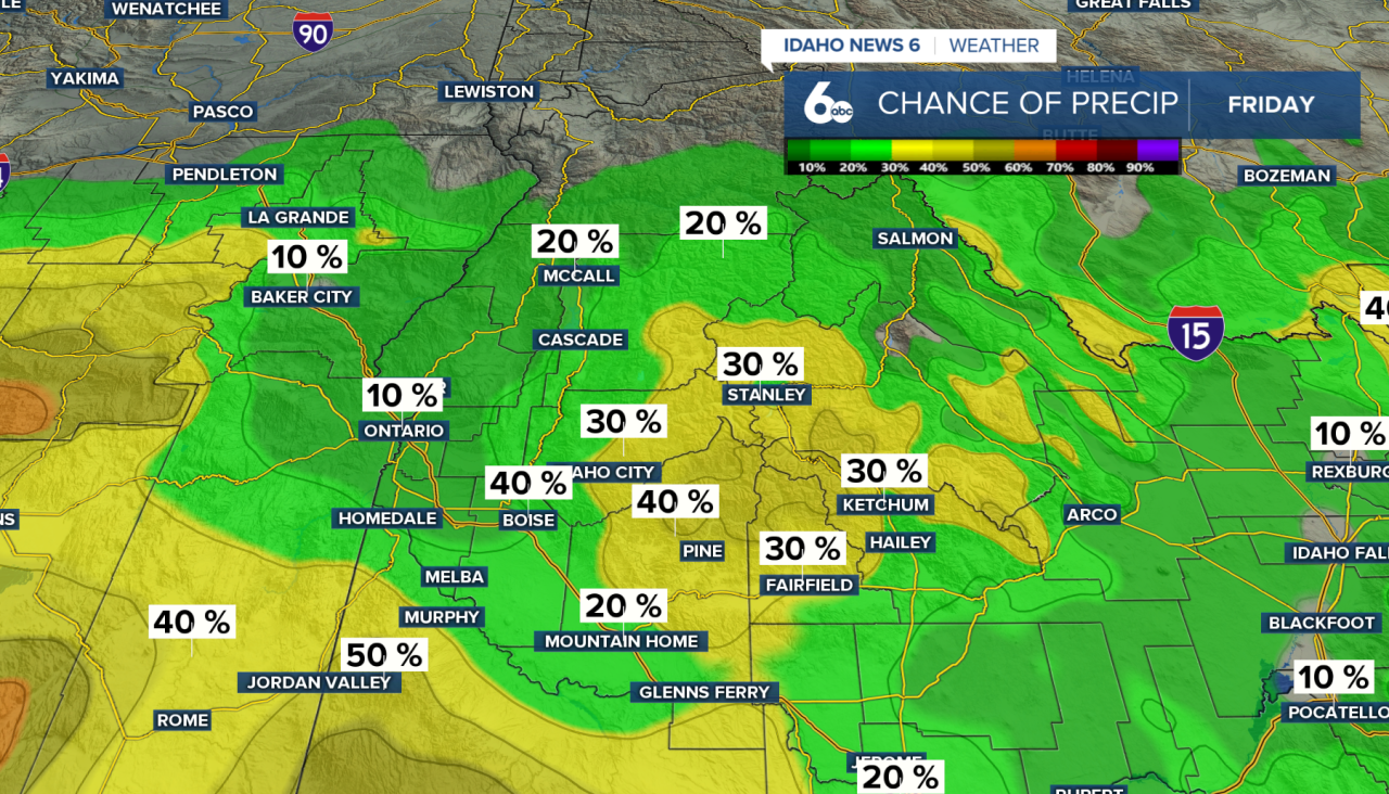
A developing low pressure system off the northern California coast will start pulling moisture into the region. This increases cloud cover and brings a 20–40% chance of showers across southeast Oregon, along with a slight chance of thunderstorms.
Thursday: More Showers, Storm Chances Expand
By Thursday, moisture spreads farther north and east, bringing more widespread chances for showers and a few thunderstorms across southeast Oregon and southern Idaho.
Even with the added clouds and precipitation chances, temperatures rebound quickly — climbing back close to the 70s.
Weekend: Widespread Showers and Thunderstorms
The biggest shift arrives Friday into Saturday.
Deeper moisture and daytime instability will support more widespread showers and thunderstorms, with rain chances increasing to 60–80% by Saturday — the most active day of the stretch.
An incoming trough from the Gulf of Alaska will help keep this active pattern going into Sunday.
Early Next Week: Cooler, Breezy, and More Seasonal
As the system moves inland, temperatures cool back closer to normal by Sunday into early next week.
Snow levels stay high (above 8,000 feet) through Saturday, meaning most precipitation falls as rain. However, snow levels drop to around 5,000–7,000 feet by Monday and Tuesday.
Overall, it’s a classic spring setup — warm and windy to start, followed by increasing clouds, showers, and thunderstorms.
Enjoy the sunshine early this week, because umbrellas — and maybe even a jacket — will be needed again soon.