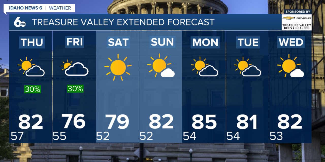
Wednesday will be the quietest weather day of the next several, with slightly warmer temperatures, mostly dry conditions and light winds across much of the region. However, changes arrive quickly as another low-pressure system moves closer to the area.
Tonight will turn chilly, especially in the higher elevations. Temperatures near freezing could lead to areas of patchy fog and frost in some mountain valleys.
Moisture will begin creeping north into the region later Wednesday, bringing a slight chance for a shower or isolated thunderstorm across south-central Idaho during the evening. Most locations, including the Treasure Valley, should remain dry through Wednesday.
Storms Return Thursday
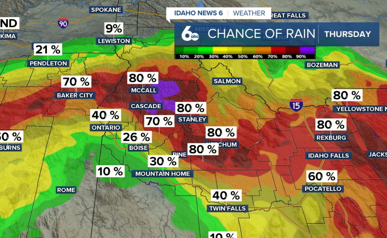
Rain and thunderstorm chances increase Thursday as low pressure moves into northern Nevada. Showers will become more widespread across the Treasure Valley, central Idaho mountains and southeast Oregon.
Some of the strongest storms are expected across south-central Idaho and far southeastern Oregon Thursday afternoon and evening. A few storms could become strong, producing heavy rainfall, small hail and gusty outflow winds approaching 50 mph.
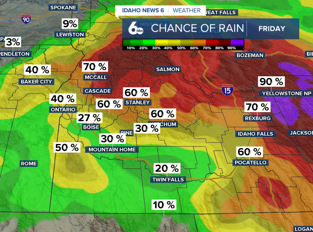
Showers and thunderstorms will remain possible into Friday, especially across northeast Oregon and central Idaho. Temperatures will also cool slightly Friday as the system moves through.
Warmer and Drier Weekend Ahead
Conditions begin improving heading into the weekend. A few lingering showers will remain possible across northeast Oregon and central Idaho Saturday, while most of the region trends warmer and drier.
High pressure builds across the West Sunday, starting another stretch of quieter weather. Temperatures will gradually warm back toward seasonal averages through early next week, with Boise expected to reach the low 80s Monday.
There is still some uncertainty heading into the middle of next week. Another system could pass to our north around Tuesday or Wednesday, potentially bringing a slight cooldown and a small chance for mountain showers.