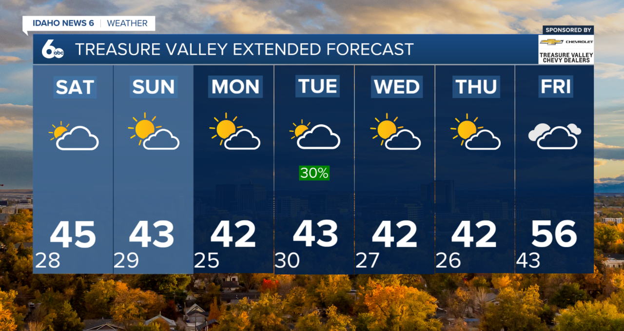


The Weekend
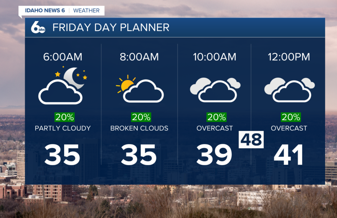
Fog is still hanging around parts of the Treasure Valley and western Magic Valley this morning, but it should clear quickly once a Pacific cold front moves in after sunrise. That front won’t bring a lot of moisture, but light snow will head into the East and West Central Mountains this afternoon.
Behind the front, northwest winds pick up this afternoon—mainly 15–25 mph across the Snake Basin, with gusts near 35 mph east of Mountain Home. Not strong enough for an advisory but definitely breezy.
Skies clear out tonight with colder temperatures settling in through Saturday morning. Clouds return late Saturday as another weak system drops in from British Columbia. With the cold air still in place, most areas could see light snow Saturday night. The Treasure Valley may get just a dusting with very minimal travel impacts.
Next Week
A brief ridge Monday keeps conditions quiet, but another upper-level trough slides through Monday night into Tuesday. It doesn’t have much moisture, so only light precipitation is expected. Snow levels stay around 2,500–3,500 feet, meaning the lower valleys could see a rain/snow mix. There’s only about a 10% chance of actual accumulation in the Treasure Valley. Winds turn breezy on Tuesday as the system exits.
Wednesday and Thursday look cool and mostly dry under northwesterly flow—pretty typical for early December. Central Idaho mountains hold a low 15–25% chance of light snow.
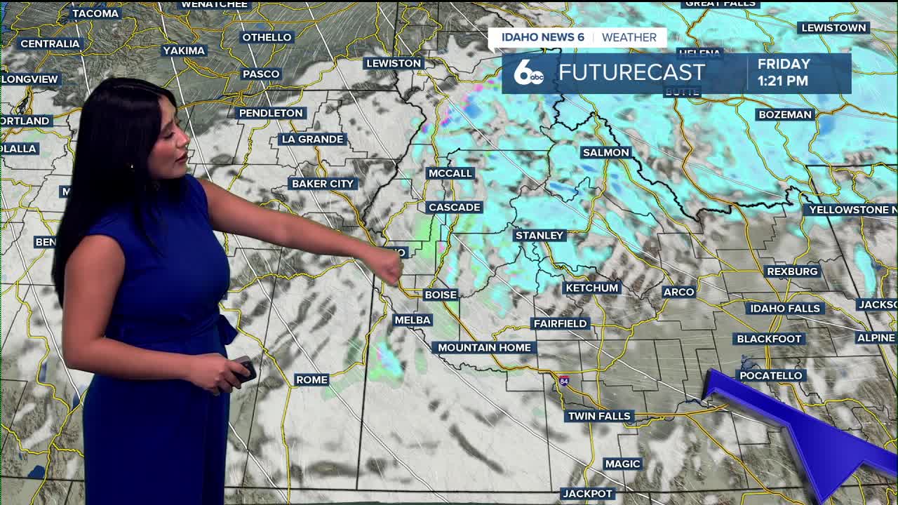
Friday is the wildcard. Models disagree on whether the ridge breaks down or hangs on. If it flattens, we could see a wetter, milder pattern develop. If not, we stay mostly dry. Right now, forecasts show a broad 20–50% chance of rain and snow on Friday, but confidence is low, and trends will need to be adjusted.
Stay up to date right here https://www.instagram.com/sophiacruzwx/?hl=en