

Updates as of 11:03 am:
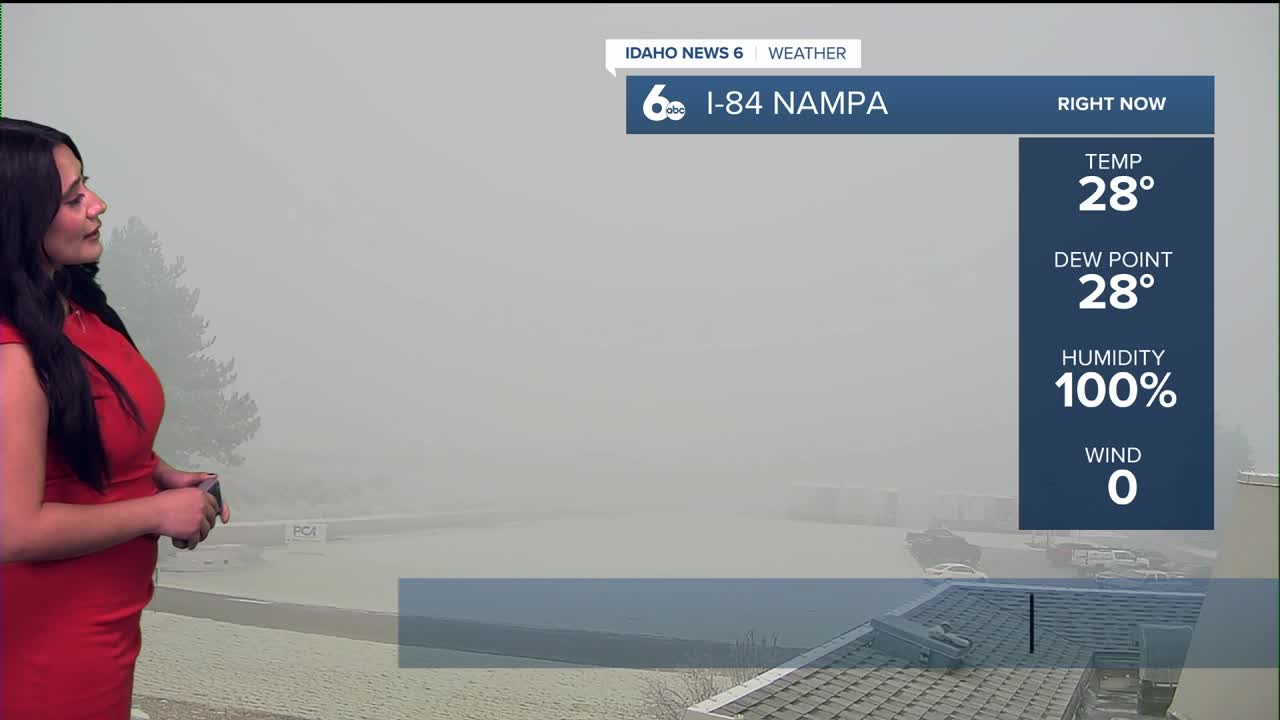
Dense fog is still hanging tough across the Treasure Valley, and it’s now expanded into parts of the Magic Valley and the West Central Mountains. The Dense Fog advisory from this morning across the Treasure Valley has now been extended into 1 pm. The areas shaded in red are where visibility has dropped to a quarter mile or less — and while we’ve seen some improvement since this morning in portions of the Treasure Valley, the bottom line is: it’s foggy almost everywhere right now.

With how thick this fog has been, we’re also seeing frost form along roadways. That’s because moisture from the fog settles on surfaces and then freezes in the colder temperatures beneath the fog layer. This can create slick spots, especially on bridges, overpasses, and untreated roads.

If you’re traveling along I-84, take it slow, give yourself extra stopping distance, and use low beams.
We should see better visibility late this afternoon — around 3 to 4 PM — with some of the best improvements expected in southeast Boise.

Weather Driver
High pressure remains firmly in control through the weekend and into next week, keeping our weather pattern unchanged. This is primarily why valleys are locked under a strong temperature inversion, meaning plenty of low clouds and fog—especially overnight and during the morning hours—while mountains enjoy more sunshine and milder temperatures.
Looking ahead, the ridge of high pressure is expected to persist through midweek, keeping conditions dry. Valley temperatures will remain below normal due to persistent fog, while mountain temperatures stay above normal. Toward late next week, there are signs the pattern could finally break down, allowing colder air and a chance for light mountain snow, along with improved air mixing in the valleys.
For now: quiet, dry, foggy in the valleys, and mild in the mountains.
Prepare for extra time on Friday mornings commute again.
7-Day Forecast

Sun Valley

McCall
