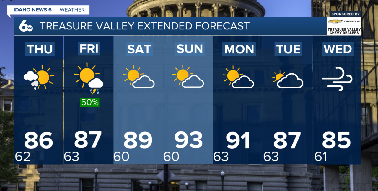
Today will be the final warm, dry day before a cooler, wetter weather pattern settles into southern Idaho. Highs will generally reach the mid-80s to mid-90s across the lower elevations and high desert. Most of the region stays dry, although there is a 15–25% chance of an isolated shower or thunderstorm near the Idaho/Nevada border, mainly in far southern Twin Falls County.
Changes begin Thursday as a weather system moves into the Pacific Northwest while monsoonal moisture pushes north into Idaho. Showers and thunderstorms will become more widespread during the afternoon and evening, with the best rain chances near the Idaho/Nevada border and across the Central Idaho Mountains. Rain chances in these areas will range from about 30–50%, with a 15–25% chance of thunderstorms.
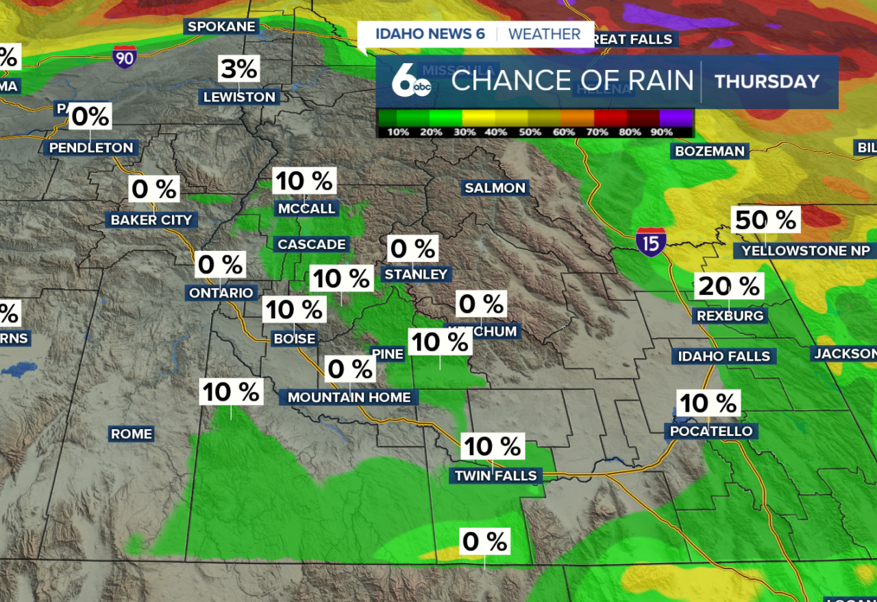
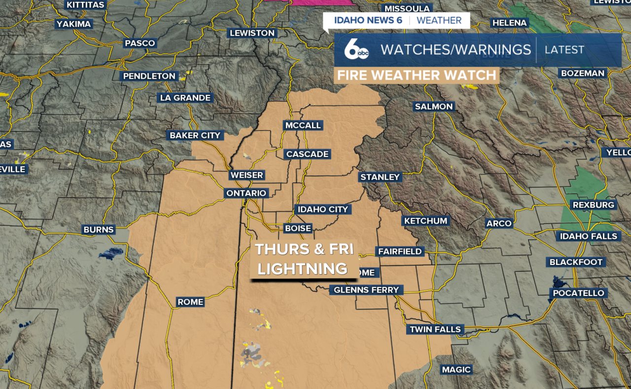
Thursday's storms may not produce much rain at first because the air near the ground will still be relatively dry. Instead, gusty winds and lightning will be the main concerns. That combination could increase the risk of new wildfire starts or cause existing fires to spread. Some showers and a few rumbles of thunder could continue overnight Thursday into early Friday. Due to the increased fire weather concerns, a Fire Weather Watch is in effect Thursday through Friday.
Friday brings the best chance for widespread rain across southwest Idaho as considerably more moisture moves into the region. Rain chances climb to 60–90% near the Idaho/Nevada border and across the Central Idaho Mountains. By this point, storms will have more moisture to work with, shifting the main concern from gusty winds to locally heavy rainfall.

Heavy downpours Friday could cause localized flooding, especially over recent burn scars and steep or rocky terrain where water can quickly run downhill. Debris flows will also be possible in vulnerable areas. Temperatures will noticeably cool, with Friday's highs running around 5 degrees below normal.
The unsettled pattern sticks around Saturday with scattered showers and isolated to scattered thunderstorms. Plenty of moisture will remain in place, so locally heavy rain will continue to be a concern. Conditions gradually begin to dry out and warm up Sunday into early next week as high pressure builds back into the region, although a few afternoon showers or thunderstorms may linger over the higher terrain.
Enjoy the warmer and mostly dry weather Wednesday. Rain and thunderstorm chances increase Thursday, with gusty winds and lightning initially creating fire weather concerns. By Friday and Saturday, heavier rainfall becomes the bigger concern as temperatures cool below normal.