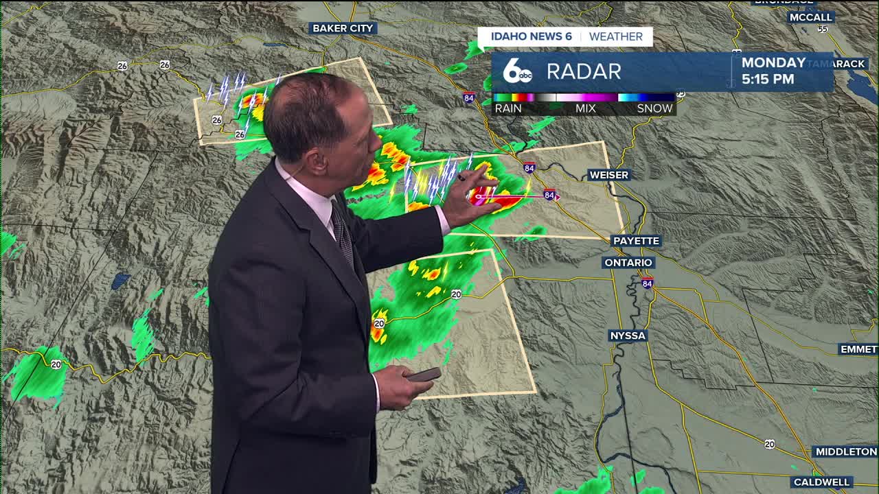


Boise is typically 94° this time of year, but only hit the mid-80s on Monday. Some isolated storms will hit the western valley and central mountains Monday evening, then warming starts Tuesday.
Monday Evening
Mostly sunny with isolated storms/gusty wind in the western valley. Temperatures falling into the 70s after sunset.
Tonight
Mostly clear, with a low around 59. Diminishing NW wind.
Tuesday
Sunny & warmer, with a high near 89. Light wind.
Wednesday
Sunny and hot, with a high near 92. Light wind.
Thursday
Mostly sunny, with a high near 87.
Friday
Sunny, with a high near 85.
Friday Night
Mostly clear, with a low around 57.
Saturday
Sunny & very warm, with a high near 89.
Saturday Night
Mostly clear, with a low around 61.
Sunday
Sunny and hotter, with a high near 92.
Monday
Sunny and hot, with a high near 94.
Stay connected right here for updates to my forecast!