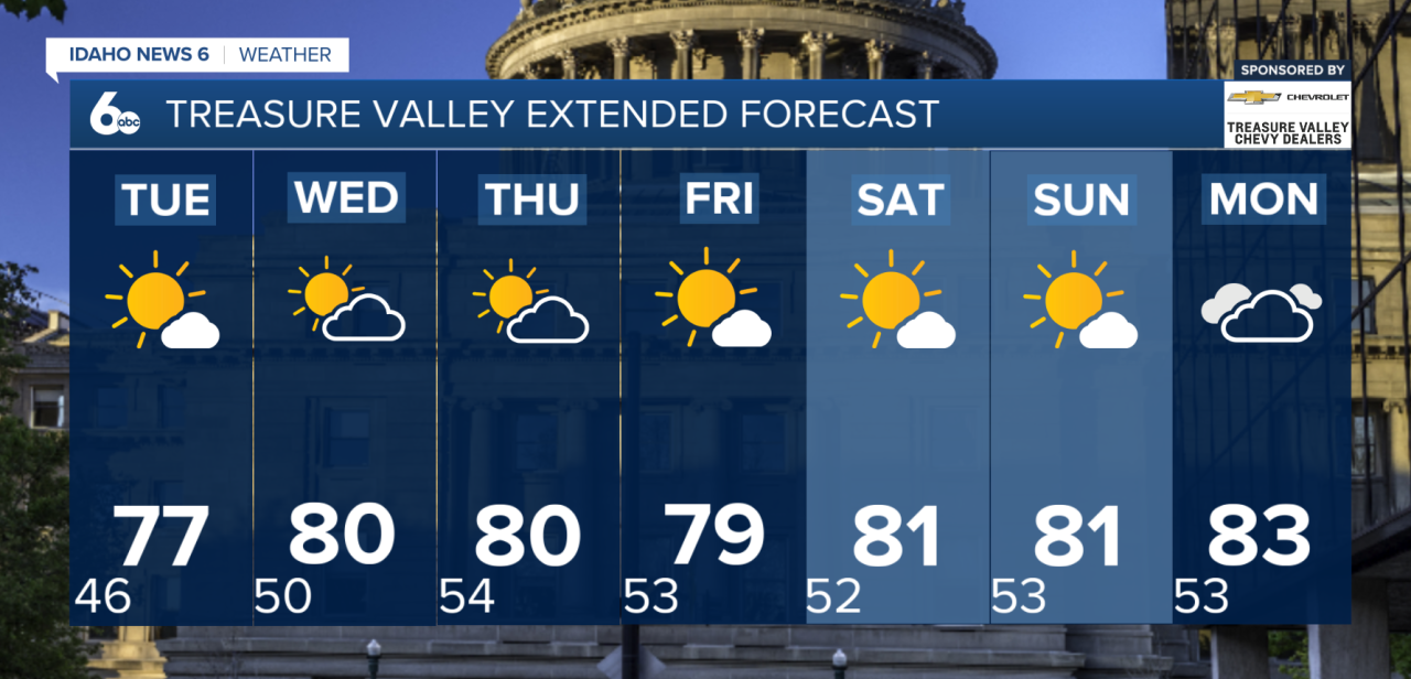
A cool and breezy start to the week will eventually give way to warmer and drier weather across the region.
Monday will stay on the cooler side as an area of low pressure continues to move away from the region. Breezy westerly winds are expected throughout the day, while a few lingering showers remain possible across the central Idaho mountains and northeast Oregon. Some patchy fog and low clouds may also develop early this morning, especially around higher terrain, before conditions gradually clear by late morning or early afternoon.
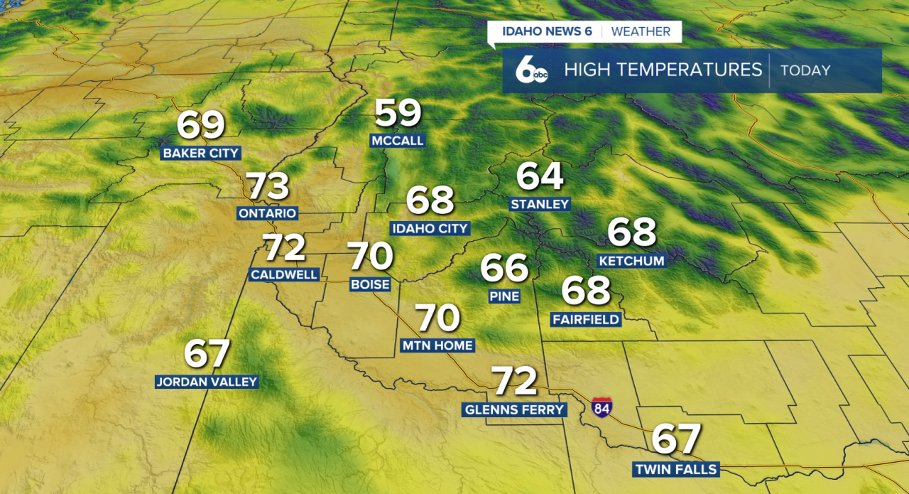
Quieter weather settles in Tuesday and Wednesday. Temperatures will remain slightly below normal Tuesday before gradually warming Wednesday. Winds will also become lighter, with mainly dry conditions expected for most locations.
Another change arrives around Thursday as a new area of low pressure moves into the region. Moisture moving north into south-central Idaho will increase the chance for showers, especially across the higher terrain. A few isolated thunderstorms will also be possible Thursday afternoon as temperatures turn cooler once again.
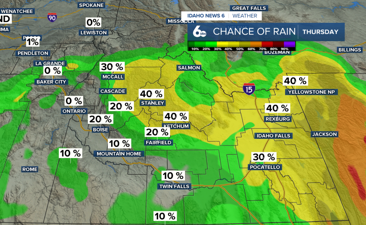
Cool and somewhat unsettled conditions continue into Friday, although rainfall looks limited. Any lingering showers should mainly favor the higher elevations of northeast Oregon and the West Central Mountains.
By the weekend, the weather pattern takes another turn. High pressure is expected to build across the Intermountain West beginning Saturday, bringing back dry conditions and above-normal temperatures. The warmer and quieter weather should stick around through Monday before another weather system potentially approaches by the middle of next week.