


A cool and breezy day is ahead as a broad upper-level trough keeps strong westerly winds moving across the region. Gusts could reach 40 to 45 mph this afternoon, especially across the western Magic Valley and southern highlands.
High temperatures will be the coolest of the week, staying in the 30s in the mountains and mid-40s across southern valleys.
Forecast: Windy and cool weather ahead of mountain showers and a weekend warm-up
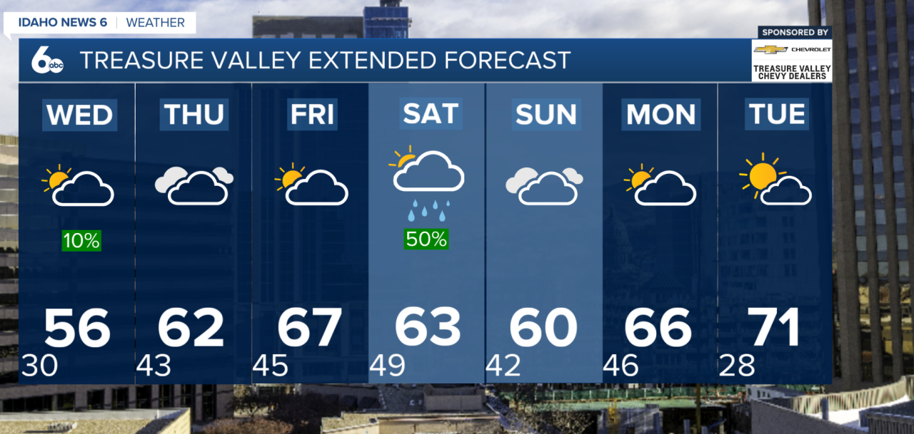
Conditions begin to shift midweek as a ridge of high pressure builds into the Great Basin. This will kick off a rapid warming trend on Wednesday and Thursday, with temperatures climbing about 10 degrees warmer on Wednesday and another 8 degrees warmer by Thursday. Snow showers will linger in the northern mountains through Thursday, but rising snow levels could bring rain to some northern valleys.
Warm and breezy weather continues into Friday, with temperatures running 10–15 degrees above normal. While most of the region stays fairly dry, northern areas of Baker County and west-central Idaho could see occasional showers with snow levels between 6000 and 7500 feet.

Changes arrive again Saturday as a powerful cold front pushes through the region. This will bring strong winds and cooler temperatures, with gusts potentially exceeding 50 mph across parts of the Magic Valley and Camas Prairie. Snow levels will drop behind the front, though most precipitation will remain focused over higher terrain due to valley shadowing.
By Sunday, the system moves out but leaves behind breezy and cooler conditions.

Looking ahead, another ridge builds early next week, bringing dry weather and another round of warming. By Tuesday, temperatures in lower elevations could climb into the 70s for the first time this year.
Overall, prepare for kite-flying weather and keep the umbrella handy in the week ahead.
Treasure Valley Extended Forecast:
McCall Forecast:
