Good morning, everyone!
We are kicking off the week with a rainy and snowy Monday. Expect a wet, soggy morning commute across the Treasure Valley. Meanwhile, snow is continuing to pile up at Bogus Basin. As of 6:30 a.m., there was already about a foot of snow on the ground!

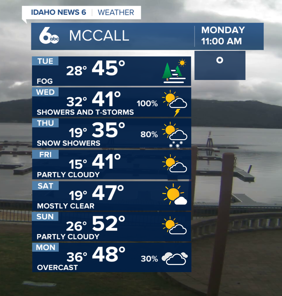
Overnight into this morning, wraparound moisture will keep rain going in the valleys and snow falling above about 4,500 feet. Areas like McCall and Idaho City could pick up 1 to 3 inches of snow early in the day, afternoon highs should help that melt off fairly quickly. Rain and mountain snow will continue mainly north of Mountain Home through midmorning, with breezy southwest winds.
By this afternoon, the low-pressure system will begin moving east, and precipitation will gradually taper off. A few graupel showers and even an isolated thunderstorm could develop over southeast Oregon before drifting into southwest Idaho during the afternoon and early evening. Skies then clear out through Tuesday morning, which may allow fog to form in area valleys, especially in higher terrain.
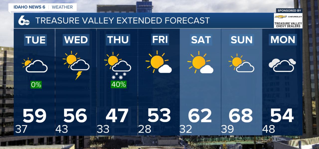
Tuesday looks to be the quiet break in the forecast, with dry conditions and cool northwesterly flow overhead.
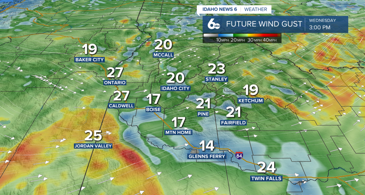
Another much colder storm system moves in Wednesday, bringing a strong cold front by the evening hours. That front is expected to produce gusty winds, isolated thunderstorms, and another round of widespread precipitation. Temperatures will fall quickly Wednesday night, and many higher elevation areas will switch from rain over to snow.
The coldest part of this stretch arrives Thursday into Friday. Snow levels are expected to drop all the way to near valley floors Thursday morning, bringing the chance for light snow, a rain-snow mix, and graupel showers across much of the region. The West Central Mountains could see more persistent precipitation, with up to 4 inches of additional snow above 4,500 feet. In the western Magic Valley, especially southern areas, there is a 40 to 50 percent chance of at least a half inch of snow. Elsewhere, accumulations should stay light or near zero.
It is also going to turn windy, with Thursday afternoon gusts between 25 and 45 mph, strongest east of Mountain Home and across the Camas Prairie. Morning temperatures Thursday and Friday will be near or below freezing for much of the Snake Plain, so anyone who already started gardening should plan to cover sensitive plants or bring them inside.
Conditions begin improving Friday as the system exits east. A warming trend is expected for the weekend, with temperatures returning to near normal Saturday and climbing 5 to 10 degrees above normal by Sunday. Another system could approach early next week, bringing rising precipitation chances again by Sunday afternoon into Monday.
Either way, pack the umbrella this week- the rain continues!
Forecast: Colder storm brings valley rain, mountain snow, late week freezing temperatures