A cold front will move across southwest Idaho and eastern Oregon Monday, bringing gusty winds, scattered rain showers and mountain snow to start the workweek.
Monday morning will begin mostly dry, with increasing clouds and breezy south to southwest winds. As the cold front pushes east, rain showers will develop across eastern Oregon before reaching southwest Idaho around midday and into the afternoon.
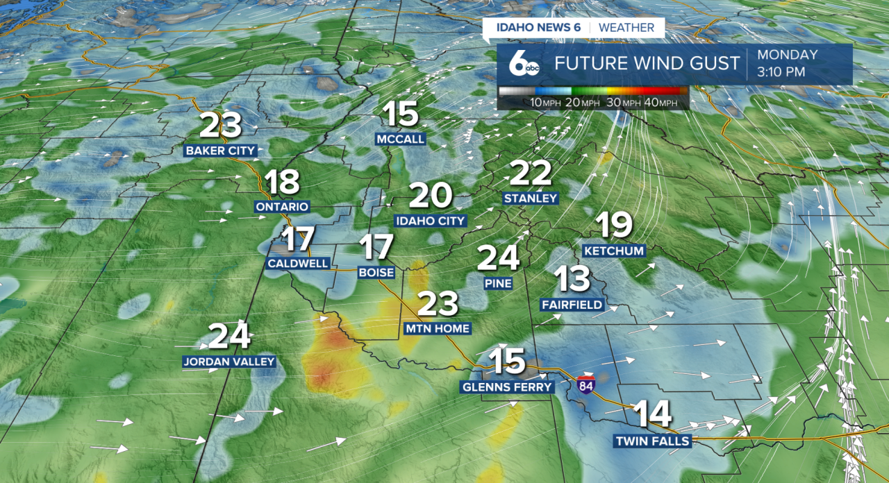
The strongest winds are expected Monday afternoon, especially across the Snake River Plain and open areas south and west of the valley. Wind gusts could reach 20 to 30 mph, with winds gradually weakening Monday evening.
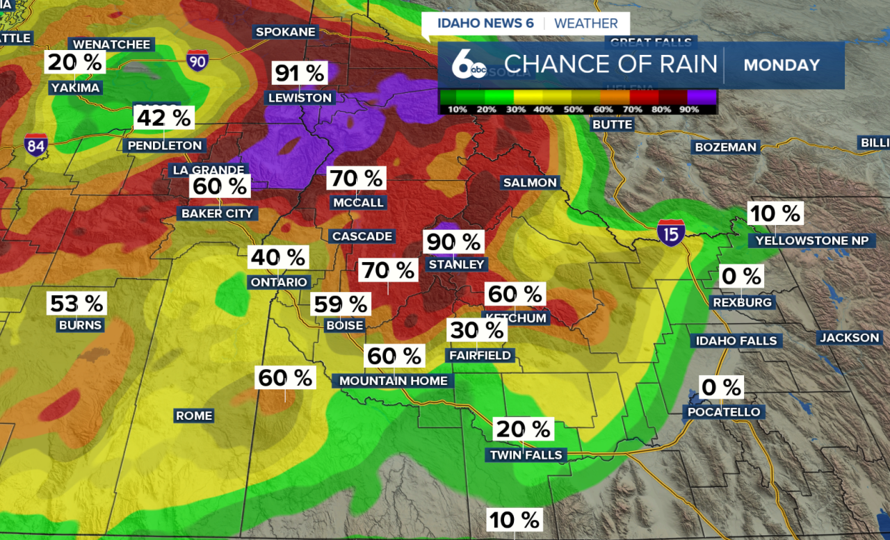
Rainfall will generally be light, with the best chances for precipitation across the Central Idaho Mountains. A few isolated thunderstorms are also possible in the mountains Monday afternoon.
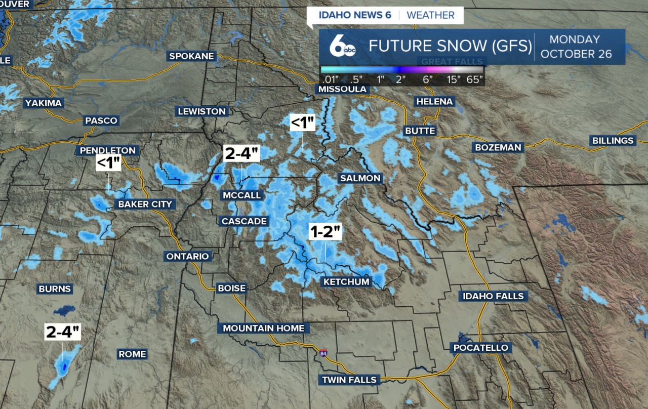
Snow levels will fall to around 6,000 feet behind the front, bringing a dusting to 2 inches of snow to higher elevations. The highest mountain peaks above 8,000 feet could receive 4 to 5 inches.
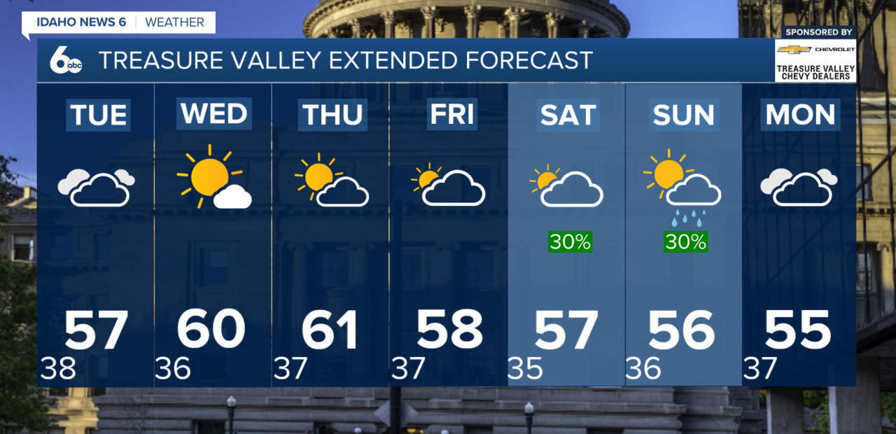
Tuesday will be the coolest day of the week, with afternoon highs in the 50s across lower elevations and 40s in mountain valleys. Lingering rain and snow showers will remain possible across northern areas through Wednesday, while much of the Treasure Valley trends drier.
Temperatures will gradually rebound Wednesday and Thursday, with seasonable fall conditions returning. Thursday looks mostly dry before another weather system approaches late Friday.
The next best chance for more widespread precipitation arrives this weekend, bringing additional rain and mountain snow to southwest Idaho and the Central Idaho Mountains.