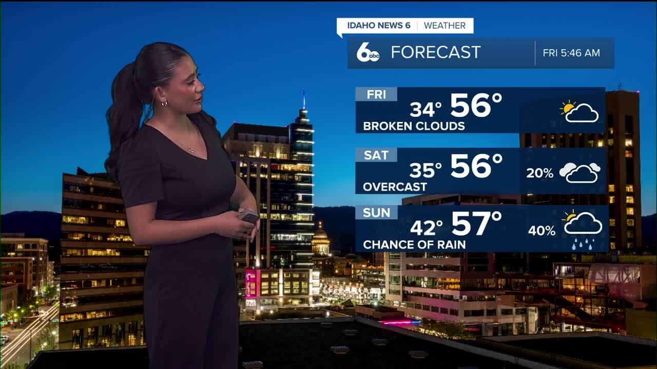
After a sunny and quiet Wednesday, temperatures are trending warmer as a weak ridge builds overhead. Expect mostly clear skies today with highs running about five degrees above normal. It’ll feel like an early taste of spring across much of the region.
Weekend: Spotty Showers, High Snow Levels
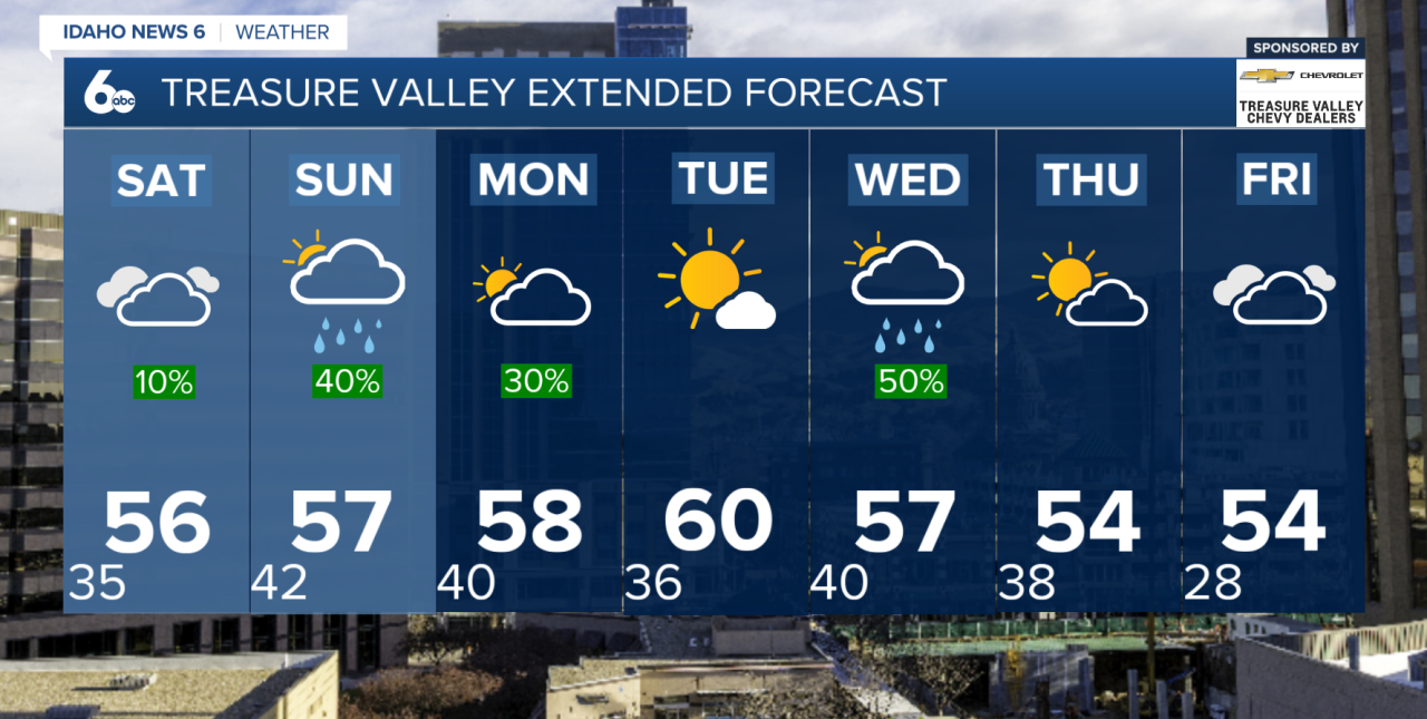
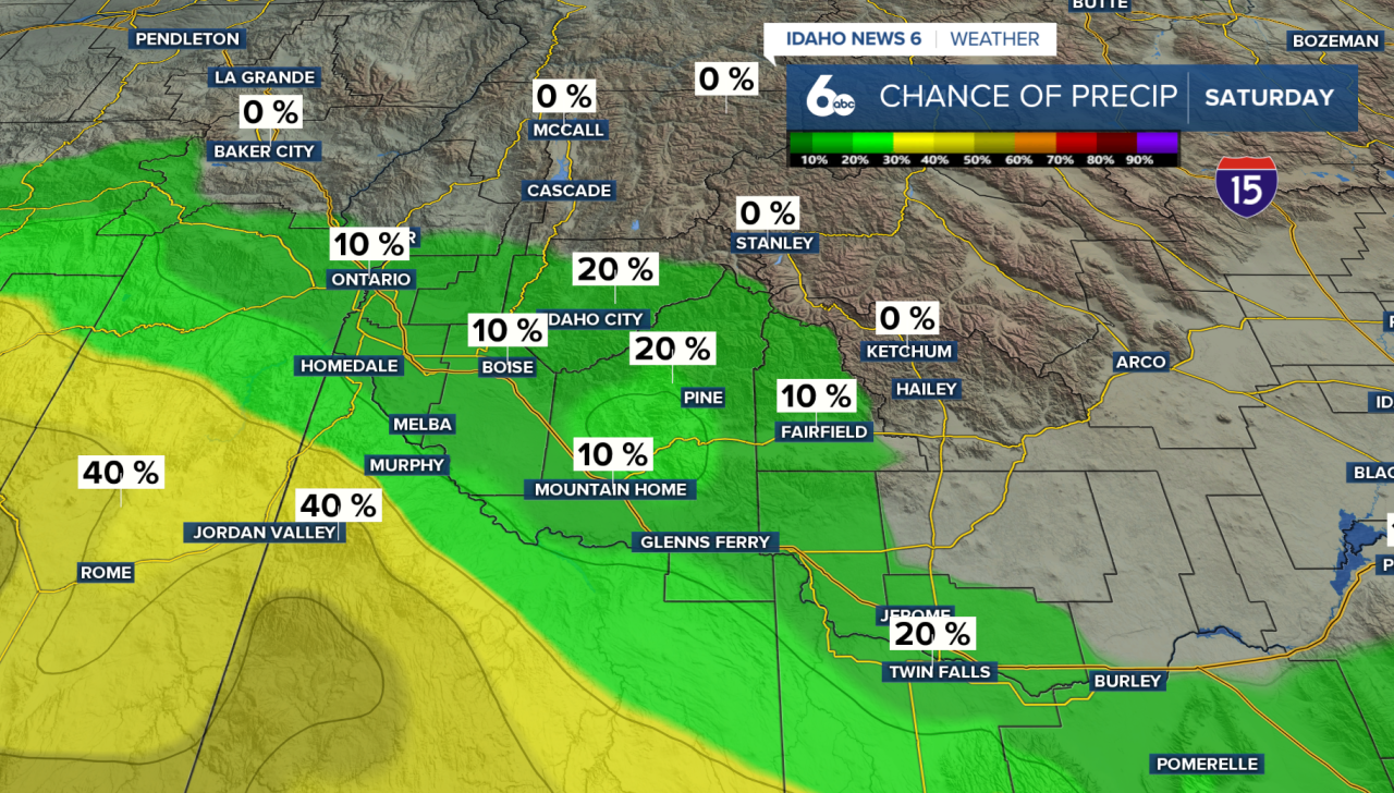
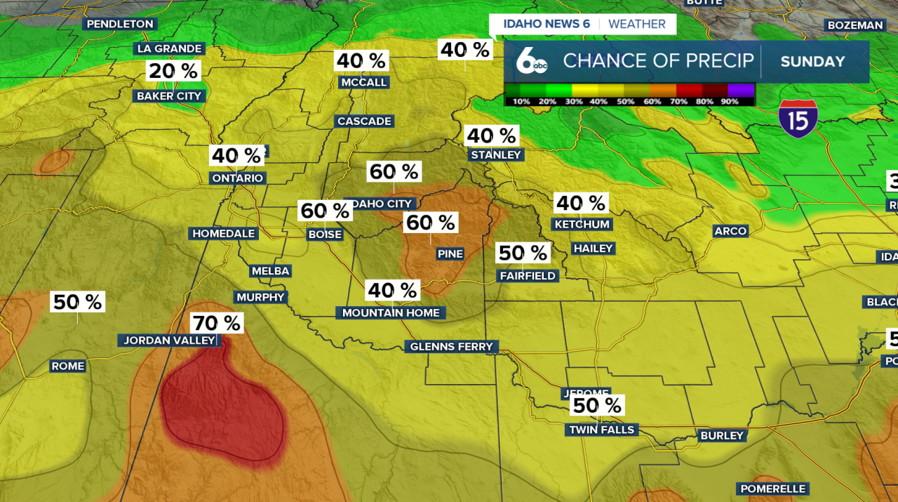
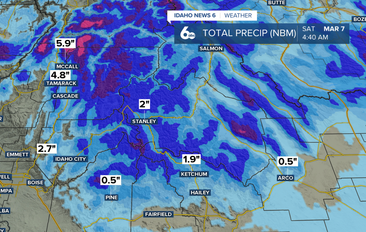
Changes arrive Saturday afternoon into Sunday as a weak system tracks from Oregon into the Great Basin. This won’t be a major storm, but it will bring a 30–60% chance of scattered rain showers.
Snow levels will stay relatively high — generally between 7,000 and 8,000 feet — meaning most valley locations will see rain if they see anything at all. Mountain snowfall looks light, with minimal accumulations expected.
Early Week: Lingering Showers, Then a Warm Boost
The weak trough will be slow to exit Monday, keeping a few showers around, mainly over higher terrain. Snow will remain confined to peaks above 7,000–8,000 feet.
By Tuesday, upper-level ridging builds back in, bringing the warmest temperatures of the extended forecast. Highs could reach the low 60s across the Snake River Plain, making it the pick day of the week.
Midweek: Potent Cold Front Drops Snow Levels
Attention then turns to Wednesday afternoon, when ensemble guidance signals a stronger cold front moving through.
This system will bring:
- Falling snow levels from 7,000–8,000 feet down to 3,500–4,500 feet by Thursday
- Snow showers over higher terrain
- Colder, unstable air lingering into Thursday
While widespread valley snow isn’t guaranteed at this point, cooler air will settle in behind the front.
Models are still showing another 2"-6" of snowfall in the mountains through next weekend.
Late Week Outlook
Conditions briefly dry out on Friday between systems. However, early signals suggest a return to cooler and unsettled weather by next weekend.