
The Treasure Valley and central Idaho are transitioning from Wednesday's wet weather to clearer, breezier conditions as an upper-level storm system moves east, bringing gusty winds and cooler temperatures before a pleasant start to the weekend.
Storm System Moving Out
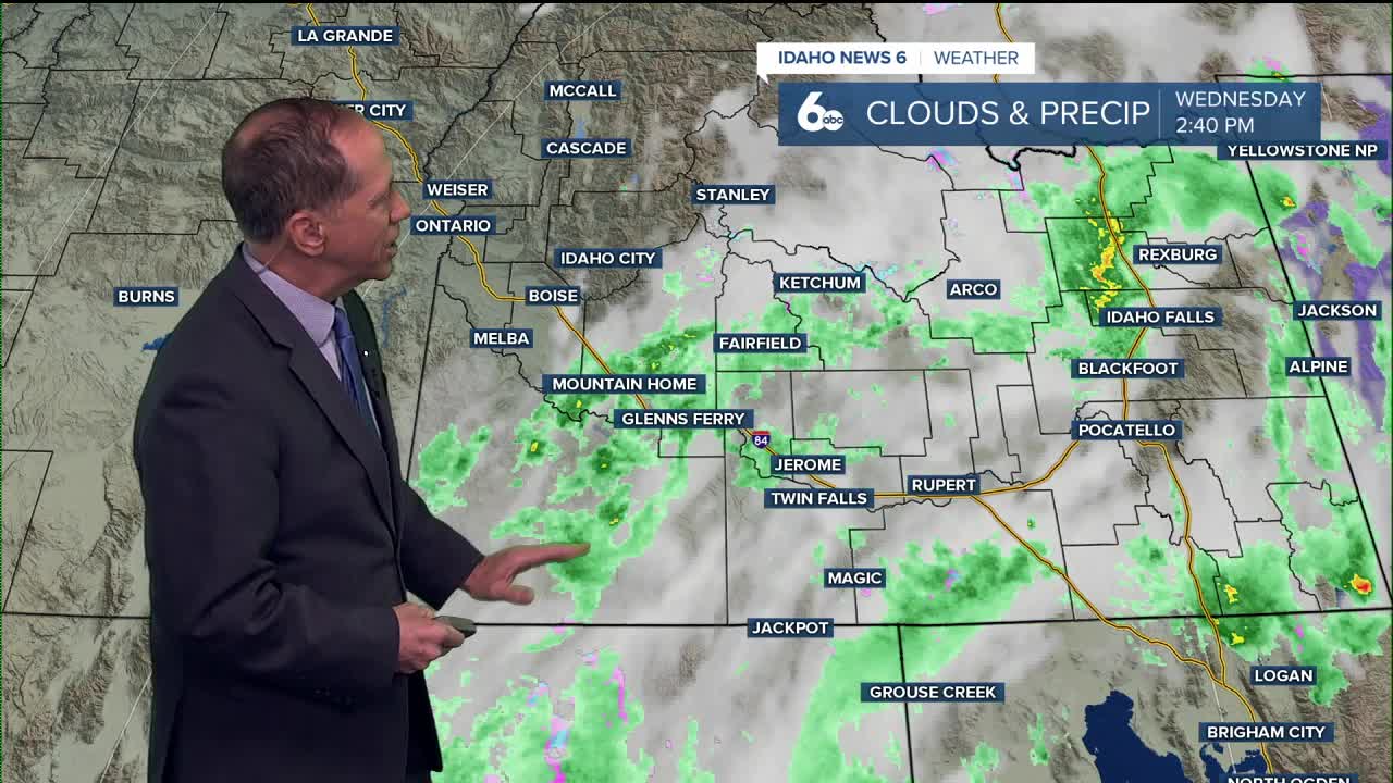
The upper low-pressure system that brought rain to the region on Wednesday is now positioned to our south and will continue moving east across Utah tonight. This departure means rain showers will decrease from west to east this evening, with the last of the precipitation ending late tonight in the Magic Valley.
This eastward movement is creating a strengthening surface pressure gradient that will keep conditions breezy Thursday.

Windy Conditions Ahead
The most notable aspect of the next few days will be the persistent winds. Breezy conditions will continue tonight into Thursday, with the increased wind activity actually providing a benefit for local agriculture - it should help prevent valley temperatures from dipping much below 40 degrees tonight.
Thursday will see the strongest breezes of the period, with afternoon gusts of 20 to 35 mph common across the Snake River Basin. The strongest winds are expected east of Boise, where gusts could be particularly noticeable for drivers of high-profile vehicles.
Temperature Trends
Temperatures will remain about 5 degrees below normal Thursday under dry northwest flow aloft. Friday will see a modest warming trend with temperatures climbing a few degrees but still remaining a couple degrees below normal for mid-October.
Overnight conditions present an interesting pattern. Thursday and Friday nights will see similar low temperatures, but lighter winds Friday night may allow more sheltered areas in agricultural valleys to dip into the mid-30s. There's about a 30% chance of temperatures reaching 36 degrees or colder in these protected areas.
Weekend Outlook Brightens
Saturday marks a significant improvement in conditions, with mostly clear, dry skies and seasonal temperatures returning. The day will be moderated by northwesterly flow under a low-amplitude ridge ahead of a weather system developing along the Canadian west coast.
However, changes are brewing for Sunday. Clouds will increase Saturday night and Sunday morning as a new trough approaches from the northwest.

Next Storm System Approaching
Weather models are showing strong agreement about the next weather maker. The first round of precipitation from this system is set to arrive Sunday around noon in eastern Oregon, with precipitation reaching Idaho late in the day Sunday.
This system will be more impactful for the mountains, with orography supporting moderate rain and snowfall over higher elevations. Precipitation chances in eastern Oregon and west-central Idaho mountains range from 60-80%, with a couple inches of snow possible along summits thanks to snow levels dropping to around 5,000 feet.

Early Next Week Cooldown
Monday will bring the most significant temperature drop of the forecast period, with highs falling to about 10 degrees below normal as winds pick up again. This cooler pattern will be short-lived, however.
Tuesday and Wednesday will see broad ridging return to the area with northwesterly flow, leading to a slow but steady warming trend and scattered clouds.
Daily Forecast
Tonight: Mostly clear, with a low around 39 degrees. West northwest wind 3 to 6 mph.
Thursday: Sunny, with a high near 60 degrees. Light west northwest wind increasing to 5 to 10 mph in the morning. Winds could gust as high as 21 mph.
Friday: Sunny, with a high near 63 degrees. Calm wind becoming northwest around 6 mph in the afternoon.
Friday Night: Mostly clear, with a low around 41 degrees.

Saturday: Sunny & pleasant, with a high near 65 degrees.
Saturday Night: Mostly clear, with a low around 46 degrees.
Sunday: A 50% chance of showers later in the day. Partly sunny, with a high near 64 degrees.
Monday: Mostly sunny, with a high near 55 degrees.
Tuesday: Mostly sunny, with a high near 58 degrees.
Wednesday: Mostly sunny, with a high near 58 degrees.
Stay connected right here for updates to the timing of when we can expect rain to return on Sunday.