Happy Friday, everyone!
It’s a cool and unsettled stretch of weather across the region, with a mix of mountain snow showers, gusty winds, and some chilly nights ahead.
Today, light snow showers will mainly impact the mountains, especially across west-central Idaho. While snow levels are low enough to reach mountain valley floors, accumulations will stay minimal. If you’re heading into higher elevations, expect brief bursts of snow and reduced visibility at times.
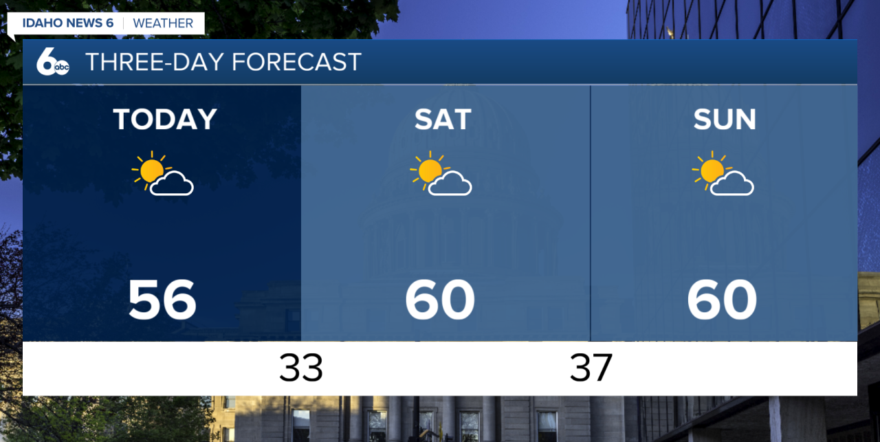
In the valley, it stays dry but breezy. Winds will pick up this afternoon with gusts between 20 to 35 mph, making it feel even cooler. High temperatures will run about 5 to 10 degrees below normal, so you’ll want an extra layer if you’re heading out.
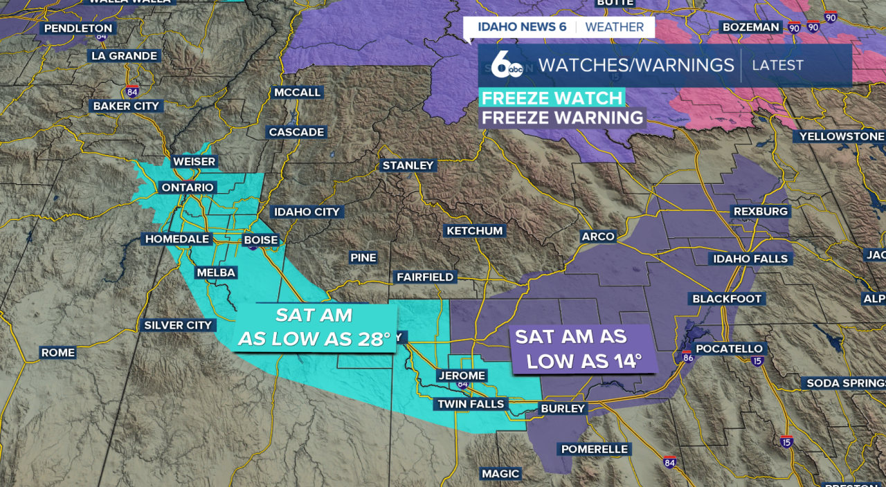
Freeze Risk Tonight into Saturday Morning
The bigger concern arrives overnight. Skies will clear and winds will calm, allowing temperatures to drop quickly. Many agricultural valleys are expected to fall near or below freezing late tonight into early Saturday morning.
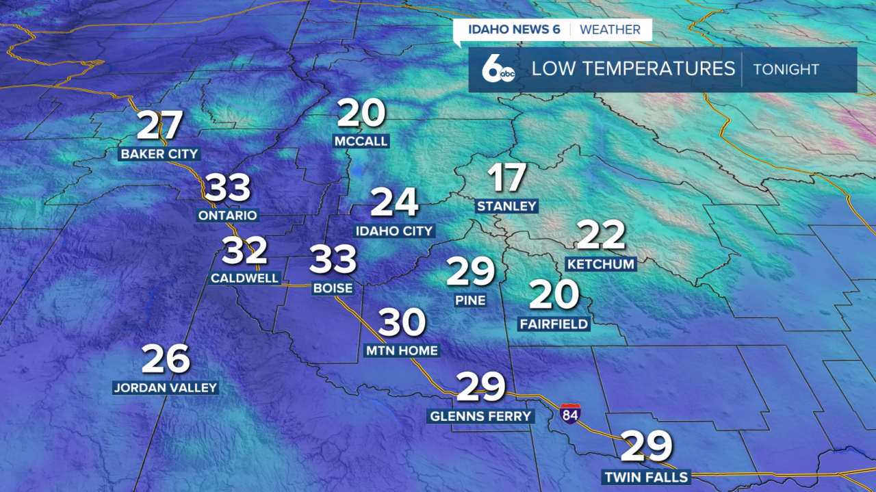
A Freeze Watch remains in effect for the Treasure Valley through Saturday morning, with overnight lows dropping between 28 and 33 degrees. These temperatures could put sensitive plants and crops at risk. Even colder air is expected in the eastern Magic Valley, where lows could drop to 14 degrees. If you haven’t already, be sure to cover or protect anything vulnerable before heading to bed.
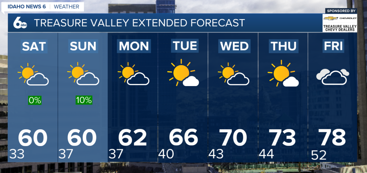
Weekend: Cool with Spotty Showers
The unsettled pattern sticks around through the weekend. Expect a mix of clouds and sun, along with scattered showers—mainly in the mountains. There’s even a slight chance of an afternoon thunderstorm each day.
Snow levels will hover between 4,000 and 5,500 feet, so higher peaks could pick up a little additional snow, but nothing major.
Winds will ease a bit on Saturday, then pick up again Sunday. Overnight, areas of frost are still likely both Saturday and Sunday nights, though temperatures won’t be quite as cold as Friday night.
Looking Ahead: Gradual Warm-Up
As we head into next week, the pattern slowly improves. Monday and Tuesday will still bring a chance of showers, especially in the mountains, but coverage will begin to decrease.
By midweek, a warming trend sets in. Temperatures will climb back to near—or even slightly above—normal by Wednesday through Friday, with lighter winds and fewer showers.
What You Need to Know
Expect breezy, cool conditions today with light mountain snow. The biggest impact will be freezing temperatures tonight into Saturday morning, so protect plants and plan for a cold start. While the weekend stays unsettled, a gradual warm-up is on the way next week.