

Good Morning Idaho!
We’ll see a bit of a weather shift today as high pressure slides east and a Pacific system approaches the coast. That means increasing clouds across southwest Idaho later today.
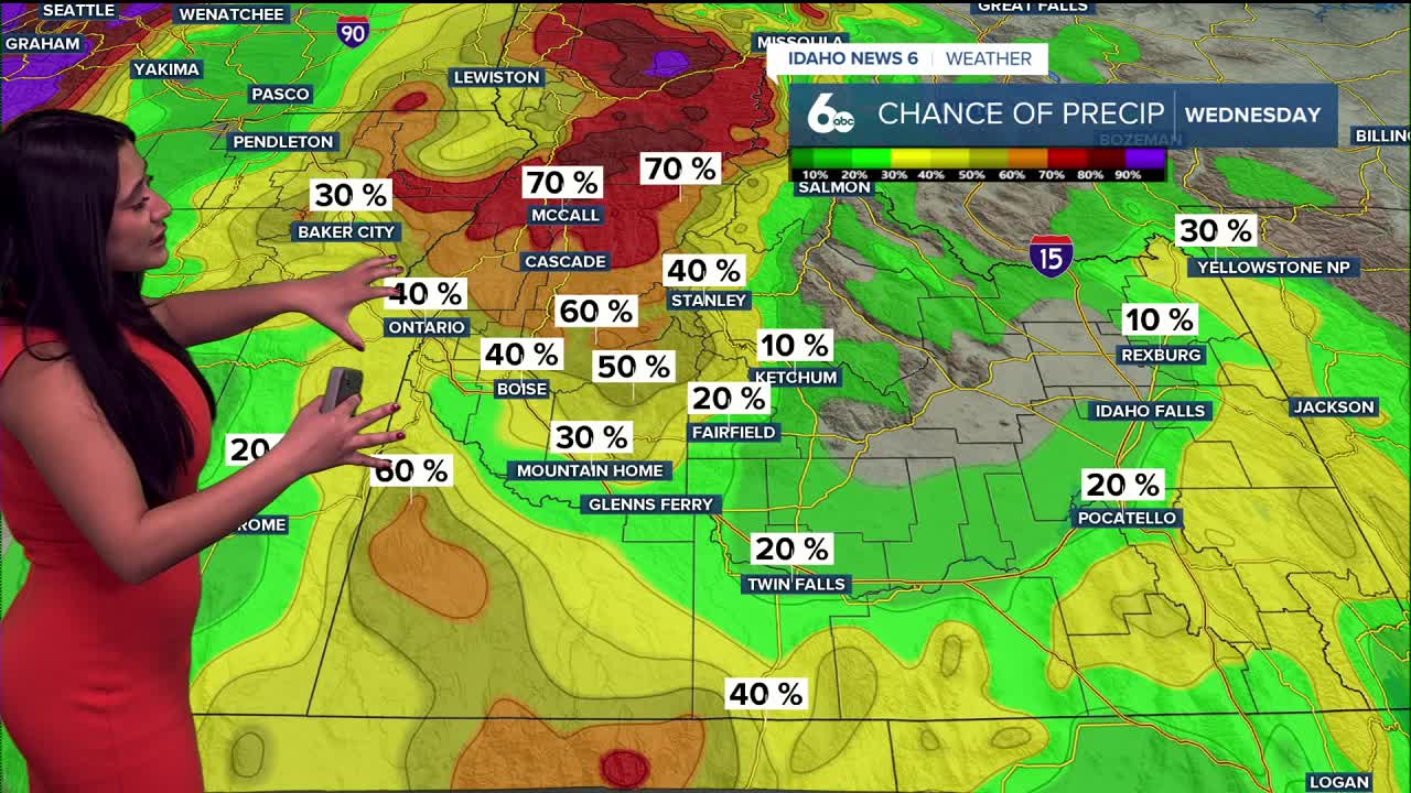
Wednesday morning is the main weather-maker this week. A cold front will move through early, bringing:
- Breezy northwest winds (gusts 25–35 mph), especially in the Magic Valley and the Owyhee Mountains
- A low chance for snow showers, mainly between 5–10 AM in the Treasure Valley
Confidence is still low on how much moisture actually reaches the ground. Some models keep Boise dry altogether. While showers will be very hit-or-miss, if precipitation does fall, it will be snow. Amounts would be very light — a dusting at most in the valleys and less than an inch in the mountains.

Temperatures stay near or slightly above average today, then cool back closer to normal behind the front on Wednesday.
By Thursday, high pressure starts to rebuild, and temperatures begin to warm back above average.
The Weekend
A stronger ridge of high pressure settles in Friday through the weekend, bringing:
- Mostly dry weather
- Above-normal temperatures
A weak disturbance on Friday could brush Baker County and west-central Idaho, with about a 30% chance of precipitation and snow levels near 4,500 feet.
Another weak system may try to break through early next week (Monday–Tuesday), but confidence is still low in how far south this will dip. That means greater uncertainty about who sees precipitation and how much cooling occurs.
Bottom line:
One brief chance for light snow early Wednesday, then a return to milder, mostly quiet weather heading into the weekend — with a few systems to watch next week.
