


Hump day brings a quiet weather pattern, with mostly dry conditions and temperatures beginning a gradual climb after several cooler days. A weak upper-level trough lingering over Montana and eastern Idaho will keep warming somewhat limited today, while also allowing a slight chance for isolated showers over eastern Valley County and portions of southern Twin Falls County late this afternoon into tonight. Most lower elevations, however, will stay dry with a mix of sun and clouds.
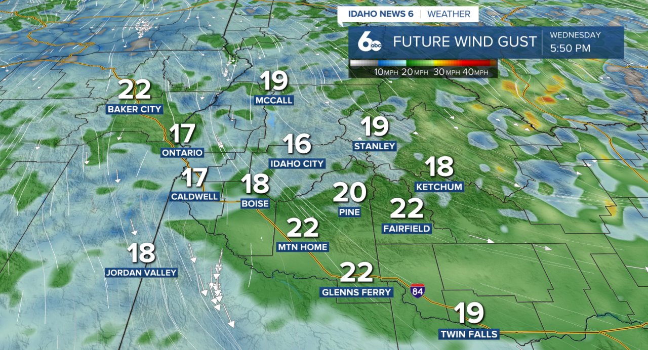
Northwest winds will increase through the afternoon, generally between 10 and 20 mph, adding a breezy feel despite temperatures slowly trending upward. Thursday will bring stronger warming as the trough exits east and high pressure begins building into the region. Winds could become slightly stronger Thursday afternoon, especially across the Snake River Plain southeast of Boise, with gusts approaching 30 mph.

The warming trend continues into Memorial Day weekend, with temperatures climbing well above average, especially on Monday. Valley locations are expected to reach the mid-80s to low 90s, with the hottest temperatures likely near Grand View. Mountain communities will also warm significantly, seeing highs in the 70s and 80s.
The warm stretch won’t last long. Forecast models continue to signal a stronger pattern shift beginning Tuesday as a cold front moves through the region. Gusty winds, cooler temperatures, and increasing chances for precipitation are expected, with some similarities to last week’s windy system that brought blowing dust and rapidly changing conditions.
