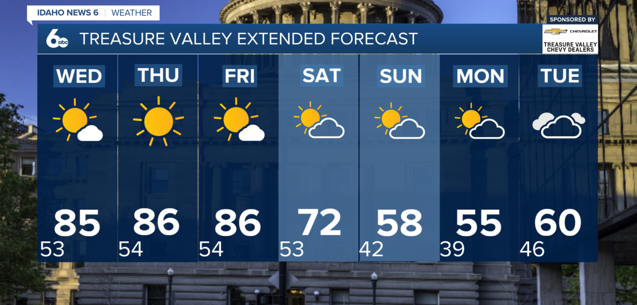
Very warm and dry weather will stick around across southwest Idaho through Friday, but a major pattern change arrives this weekend.
High pressure remains in control through the middle of the week, keeping skies mostly clear and temperatures well above normal. Afternoon highs will climb into the low to mid 80s across the lower valleys, while mountain communities reach the 70s to low 80s. Some locations could approach daily record highs.
Overnight temperatures will cool into the 40s and lower 50s, with colder mountain valleys dipping into the 30s. Even those morning lows will remain around 5 to 10 degrees above normal for early October.
Friday will bring one more warm and dry day before a cold front moves through on Saturday. Temperatures could fall 15 to 20 degrees compared to Friday, with breezy winds spreading into the lower elevations.
The cooler and more unsettled pattern is expected to continue through early next week as an area of low pressure moves through the Pacific Northwest. Central Idaho currently has a 30% to 50% chance of precipitation from Saturday night through early Tuesday, while areas farther west have roughly a 10% to 30% chance.
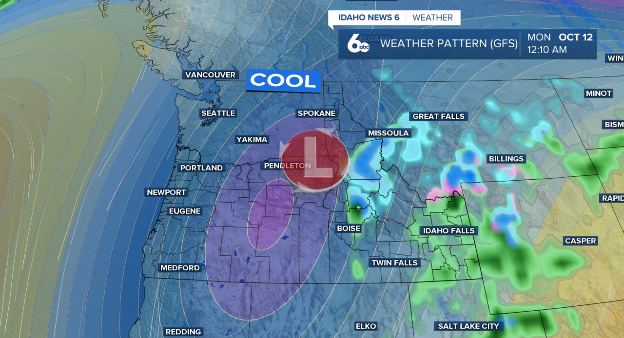
There is still uncertainty surrounding the exact track of the storm, which will determine how much rain falls and just how cold temperatures become.
By Sunday through Tuesday, highs are expected to run around 5 to 10 degrees below normal. Snow levels could fall to around 5,500 to 7,000 feet, bringing the possibility of the season’s first snow to some of the higher mountain peaks.