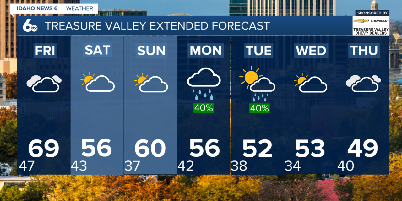
Warm and breezy through Friday
Thursday will bring another round of mild and mostly dry weather, with partly to mostly sunny skies and passing high clouds. Temperatures will remain well above average for mid-November, with some areas approaching record highs.
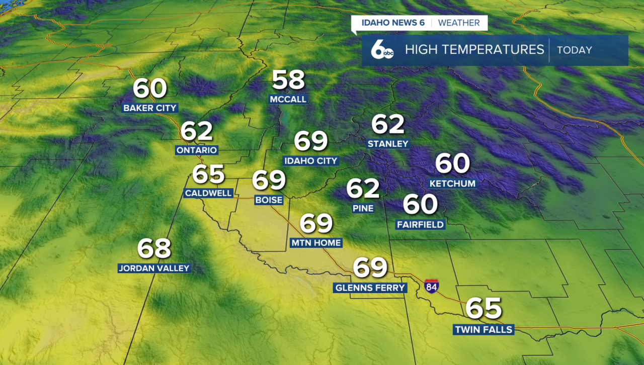
Breezy winds will also continue, with gusts between 15 and 30 mph across portions of the Snake River Plain and eastern Oregon.
By Friday afternoon, winds will strengthen ahead of an approaching cold front. Gusts could reach 35 to 50 mph across open areas of southeastern Oregon and far southwestern Idaho, with the strongest winds expected in Harney County. Elsewhere, gusts of 20 to 40 mph are possible.
Rain and mountain snow arrive Friday night
A cold front will move into central Oregon Friday afternoon before pushing east across southwest Idaho Friday night into Saturday morning.
This system will bring widespread rain to the valleys and snow to the higher mountains. Most lower elevations can expect between 0.05 and 0.25 inches of rainfall, while mountain locations could receive 0.20 to 0.50 inches of precipitation.
Snow levels will initially remain above 7,000 feet before dropping to around 6,000 to 7,000 feet behind the front. This means accumulating snow will mainly be limited to higher mountain elevations.
The system will move through quickly, with precipitation gradually ending from west to east late Friday night through Saturday morning.
Saturday's high temperatures will drop roughly 10 to 15 degrees compared to Friday, although conditions will still be slightly warmer than normal for this time of year.
More rain and mountain snow possible next week
Sunday will bring a brief return to warmer, breezy conditions before another series of storms moves into the region.
Rain and mountain snow chances increase to 50 to 70% from late Sunday through Tuesday. Snow levels will gradually lower from around 5,500 to 6,500 feet Sunday night to between 4,000 and 6,000 feet by Tuesday.
Temperatures will also continue cooling as the week progresses.
Another storm system could arrive Wednesday into Thursday, bringing a 30 to 50% chance of additional precipitation. This system may carry colder air, potentially lowering snow levels to around 3,500 to 5,000 feet.
While the exact timing and strength of next week's storms remain uncertain, the overall trend points toward a cooler and more active weather pattern across the Treasure Valley and surrounding mountains.
By late next week, temperatures are expected to return closer to seasonal averages, marking a noticeable change from the near-record warmth experienced this week.