

Good morning, everyone! Thanksgiving is around the corner, and December isn’t far behind. Mother Nature is slowly delivering fresh mountain snow this week—and a noticeable drop in temperatures is on the way.
Today
A warm front is moving through the region this morning, bringing periods of light precipitation mainly to northern areas. In the colder valleys of Baker County, temperatures may hover near freezing early, allowing a brief period of light freezing rain before conditions warm enough for plain rain. Any icy spots should be minimal and short-lived. However, drive with caution into the lower Treasure Valley.
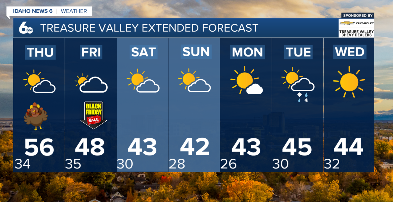
Through the afternoon, the warm front will move north of the area, and rain will taper off. Clouds will stick around during the day, but skies will begin to clear from the southwest overnight. Temperatures will warm into the 40s and 50s. A nice mild day in store!
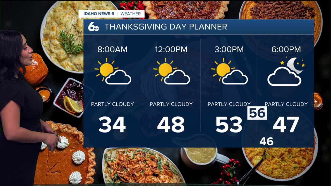
Thanksgiving Day
Some patchy morning fog is possible in the northern valleys, but most of Thanksgiving Day will be dry, mild, and pleasant. High temperatures will range from the 40s in the mountains to the mid-50s in southern valleys.
A cold front arrives Thursday night, bringing another round of light rain and mountain snow—mainly in northern areas. Snow levels will drop to around 4,500 feet, producing 1–2 inches of fresh snow in the north mountain ranges. Southern areas will likely stay dry.
Friday
Cooler air moves in behind the cold front. Expect temperatures about 5–10 degrees lower than Thursday, especially at higher elevations. Northwest winds will pick up, making it feel brisk. Northern areas have a 30–60% chance of mixed precipitation, while the south has less than a 30% chance. Skies will begin to clear Friday night, with colder overnight temperatures, but light winds should prevent a major drop.
Saturday
Cooler weather settles in with highs only in the lower to mid-40s. Snow levels drop to around 3,000–4,000 feet, so mountain areas may see light snow. A weak disturbance late in the day brings a 20–30% chance of mixed precipitation, but most places will stay dry.
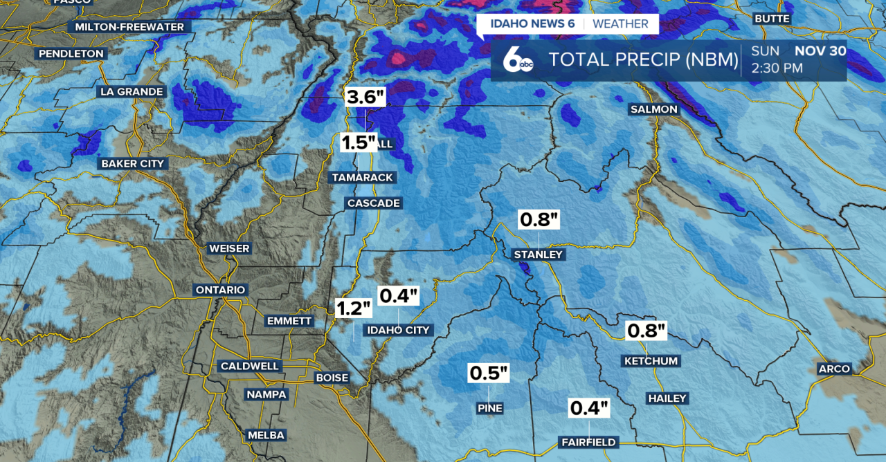
Sunday
High pressure builds in, bringing dry but still cool conditions. Temperatures again top out in the low 40s, with chilly morning lows. No significant precipitation is expected.