

Happy Hump Day! Prepare by grabbing the umbrella for today.

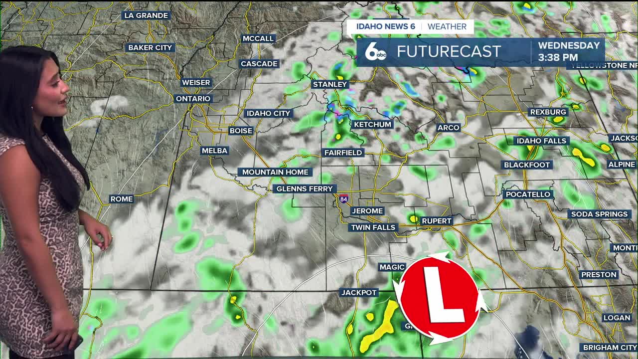
A low centered over Nevada will drift into southern Idaho today, sending another round of showers into the region. Rain will develop by the morning south of a Melba–Boise–Stanley line, with the heaviest totals of 0.25–0.50" likely between Twin Falls and Boise, especially across the Magic Valley and southern highlands.

Pockets of heavier embedded showers are possible as the system strengthens through the afternoon, and a few thunderstorms are likely in the Magic Valley and central Idaho mountains. Snow levels remain high, around 6,500–8,000 feet, keeping any snow limited to the highest peaks. However, drive safe and slowly as you head into the mountains and around valley floors today!
Showers taper off from west to east tonight. As cooler air settles in, overnight lows drop into the 30s. While northwest winds may limit formation, sheltered valleys could see patchy fog and frost early Thursday. This means grab the jacket for the next few mornings.
Thursday and Friday turn drier under northwest flow, bringing mostly sunny skies, afternoon winds gusting near 30 mph southeast of Boise, and temperatures running just a few degrees below normal.
Stay up to date right here https://www.instagram.com/sophiacruzwx/

Wednesday
Pack the umbrella, Showers likely through the morning. Mostly cloudy, with a high near 56. Light and variable wind becoming northwest 5 to 8 mph in the morning. Chance of precipitation is 60%.
Wednesday Night
A 20% chance of showers through the evening. Partly cloudy, with a low around 37. ph.
Thursday
Grab the jacket, cool, and breezy afternoon ahead. Sunny, with a high near 58. Northwest wind 10 to 14 mph, with gusts as high as 23 mph.
Thursday Night
Mostly clear, with a low around 38.
Friday
Sunny, with a high near 60.
Friday Night
Mostly clear, with a low around 38.
Saturday
Sunny, with a high near 63.
Saturday Night
Mostly clear, with a low around 46. Carry the jacket for the BSU game.
Sunday
A 40% chance of showers. Partly sunny, with a high near 65.
Sunday Night
A 40% chance of showers. Mostly cloudy, with a low around 37.
Monday
A 20% chance of showers. Mostly sunny, with a high near 52.
Monday Night
Mostly clear, with a low around 32.
Tuesday
Sunny, with a high near 53.