


Good Morning everyone
The rainy/snowy stretch of weather brought a glorious day to Brundage! I got to head up there on Thursday and check out the fresh powder and runs. In the past three days they gained 16"! Talk about Kapow! If you were there or want to send in any weather videos, I would love to see them. My email is Sophia.cruz@kivitv.com
After an active stretch of weather, conditions are beginning to settle down across the region. This morning starts off with some patchy fog in higher mountain valleys, but overall, much drier air has moved in behind the departing system.
You may notice the difference right away—dew points have dropped significantly, making for a crisp and dry feel to the air. Some mid and high clouds will linger over the central Idaho mountains early on, but skies will gradually clear as high pressure builds in from the west.
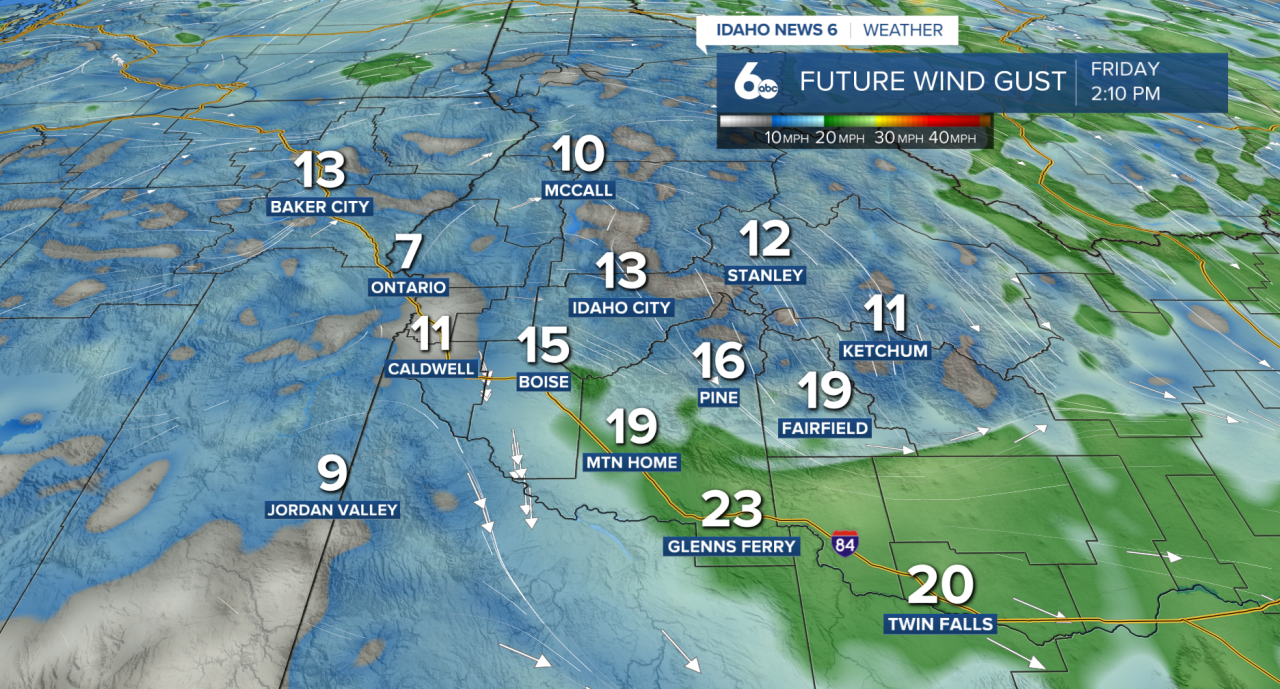
Winds will remain a bit breezy today, especially across the Magic Valley with gusts up to 25mph, but the bigger story is the shift toward calmer weather.
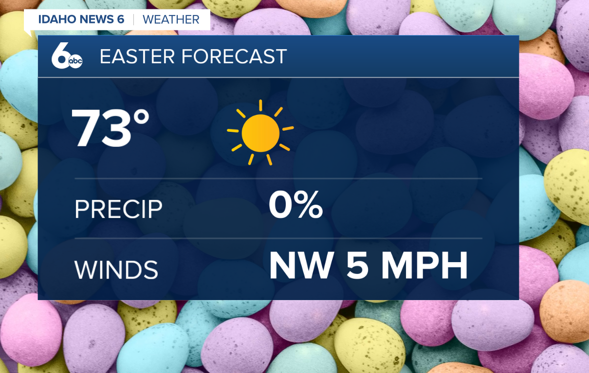
As we head into the weekend, a warming and drying trend will take hold. High pressure will dominate, bringing more sunshine and temperatures climbing back above normal each day. This means the Easter egg-hunting weather will be perfect and on the warmer side by Sunday afternoon.
Looking ahead to early next week, the quiet pattern continues through at least Monday. Beyond that, there are signs that a weak system could move through between Tuesday and Thursday- bringing a slight chance of precipitation and a modest cooldown.
For now, though, enjoy the sunshine and the taste of spring as we head into a much calmer stretch of weather.
Forecast: After a foot of snow in the mountains, a warming and drying trend will take over
Treasure Valley Extended Forecast
