

Keep those powder dances going—Mother Nature finally seems to be checking her calendar, bringing some much-needed relief from the warm, dry December we’ve had so far.
A shift in the weather pattern begins today as the recent stretch of high pressure weakens, allowing storms to return to the region (Get the skis and boards tuned).
The first system arrives this afternoon, bringing more clouds, cooler air, and light precipitation. Valley locations will mainly see rain, while snow is limited to the higher elevations, generally above 7,000 feet. Most places will see light amounts, with only minor snow accumulation in the mountains through Tuesday night.
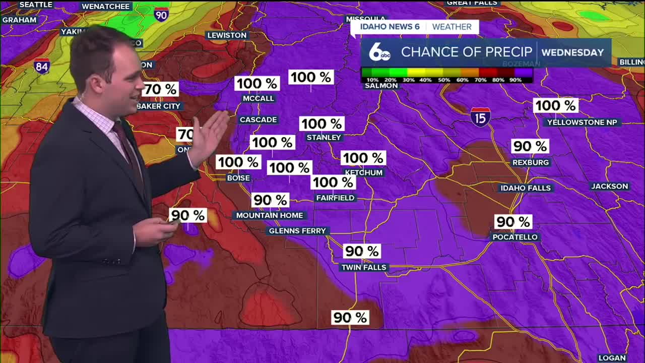
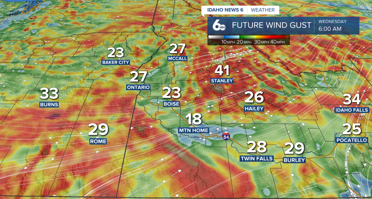
Conditions become more impactful on Wednesday as a stronger storm system moves through. Very gusty winds are expected, with sustained speeds up to 35 mph and higher gusts possible, especially near the Nevada border and in exposed areas. These winds could make travel difficult for trucks and high-profile vehicles.
Rain becomes more widespread in the valleys, while the mountains accumulate snow. As colder air moves in behind the front, snow levels drop to near 5,000 feet, and some heavier showers may briefly reduce visibility. Mountain areas could see several inches of snow from 7000 ft to 6000 ft, while lower elevations may see a light accumulation.
By Wednesday night, winds begin to ease and temperatures cool. A few snow showers may linger in the mountains, while valleys trend drier with the potential for patchy fog overnight.
Unsettled Weather Continues Late Week
Another strong and moisture-rich system arrives Thursday, bringing widespread rain, mountain snow, and strong winds that could last into early Saturday. Snow levels will fluctuate during this period, making exact snowfall totals difficult to pin down, but mountain locations have the potential for significant accumulation.
However, with already wet ground, the combination of heavy precipitation and steep terrain may increase the risk for rockslides.

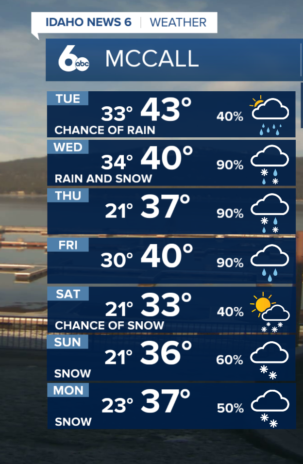
Winds strengthen late week again, especially on Friday, before a cold front moves through. Temperatures remain above average through the end of the workweek, then cool slightly over the weekend.

Looking ahead to late Sunday into Monday, another storm system may move into the region. Confidence is lower this far out, but additional rain and mountain snow appear possible as the active pattern continues.
Stay up to date right here @SophiaCruzWX

ALSO READ | What is the snowiest winter in Bogus Basin's history? And other snow stats from Boise's favorite ski hill