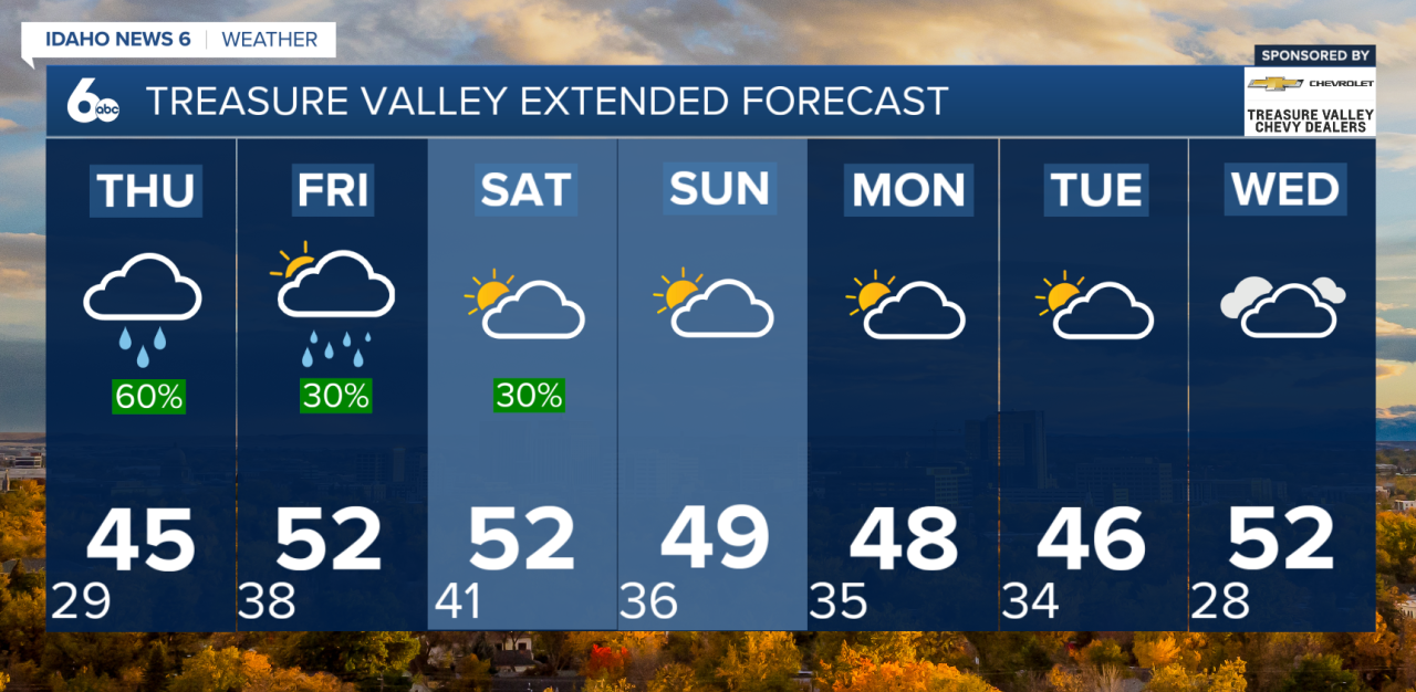
A strong ridge of high pressure will stay in place through the end of the week, keeping a temperature inversion locked in across the lower valleys. That means chilly mornings, areas of low clouds through at least Saturday. Grab the heavy coat for the mornings ahead!
Changes arrive late tonight as moisture begins to move in from the south. This is tied to a Pacific storm system approaching the California coast. Good news: rain steers clear of midnight!
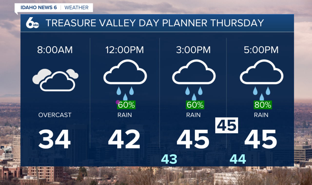
Do grab the umbrella for Thursday, however, A warm front will move through the region on New Year's Day, spreading valley rain and mountain snow from South to North.
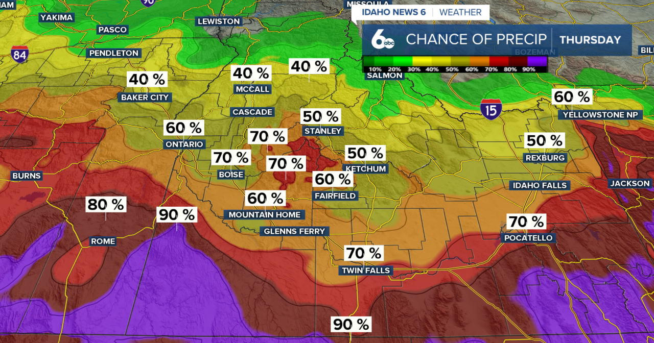
Most locations will see rain, especially in the valleys. Snow levels will start around 4,000–5,000 feet, allowing some light mountain snow early on, but they will rise quickly behind the warm front to 7,000–8,000 feet by Friday morning. Because of this, snow will transition to rain even in the mountains.
Expect soggy commutes heading into New Year’s Day. There is a slight chance of freezing rain early Thursday in the colder valleys of northern Harney and Malheur Counties, as well as Baker County. This could lead to slick spots on the roads, so be sure to drive safely.
Rain and Snowfall Totals.
By Friday morning, precipitation will taper off from the south. However, the Boise Mountains and west-central Idaho mountains will continue to see periods of rain through Friday afternoon. Rain totals from late tonight through Friday range from about 0.15 to 0.30 inches in southern areas, with 0.30 to 0.60 inches farther north, where the heaviest rain is expected.
Snowfall above 5,000 feet could total 1 to 4 inches on New Year’s Day, but warming temperatures will change snow to rain at many locations by Friday morning.
Next Week
After a brief break Friday night into Saturday, the pattern becomes more active again. A deeper Pacific storm system will approach from the southwest on Sunday, bringing another round of widespread precipitation.
As colder air works back in, snow levels will gradually lower to around 4,500–5,500 feet by Sunday, allowing more mountain snow to return.
Stay up to date right here Sophias Instagram