


Bundle up, temperatures will dip near or below freezing this morning. As we approach Friday, conditions will remain quiet. A ridge of high pressure over the region is keeping skies clear and winds light, leading to seasonable daytime highs and cold nights.
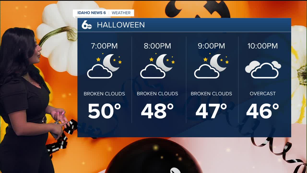
For Halloween, grab the jacket or cape as you gear up for the night!

By Saturday, the ridge axis shifts directly overhead, allowing temperatures to warm 5 to 10 degrees above normal. High clouds will increase throughout the day, leading to mostly cloudy skies by Saturday evening.
Late Saturday night into early Sunday morning, the ridge begins to move east. This will open the door for a weak weather system to bring the first chance of measurable rain in several days—mainly for northern zones from Burns, Oregon to Lowman, Idaho.
As that system passes on Sunday, a few mountain showers may linger while temperatures dip slightly. Conditions next week remain mild, with a few light rain chances on Monday and Tuesday. Snow levels will stay high—above 8,000 feet—so most precipitation will fall as rain.
By midweek, ensemble guidance shows a deeper trough approaching the Pacific Northwest. This system is expected to bring widespread precipitation, breezy winds, and lowering snow levels by Thursday.
Stay up to date right here https://www.instagram.com/sophiacruzwx/
Thursday
Sunny, with a high near 55. Calm wind becoming southeast around 5 mph.
Friday
Sunny, with a high near 57. Calm wind.
Friday Night
Mostly cloudy, with a low around 37. Calm wind becoming east southeast around 5 mph after midnight.
Saturday
Mostly sunny, with a high near 64.
Saturday Night
Mostly clear, with a low around 42.
Sunday
Mostly sunny, with a high near 59.
Sunday Night
Partly cloudy, with a low around 36.
Monday
Mostly sunny, with a high near 63.
Tuesday
Partly sunny, with a high near 64.
Wednesday
A 20 percent chance of rain. Partly sunny, with a high near 66.
