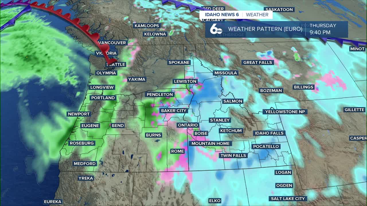


Dry and quiet weather continues today with patchy fog possible this morning, mainly across the Snake Plain. Clouds increase tonight as our next weather system approaches from the northwest.
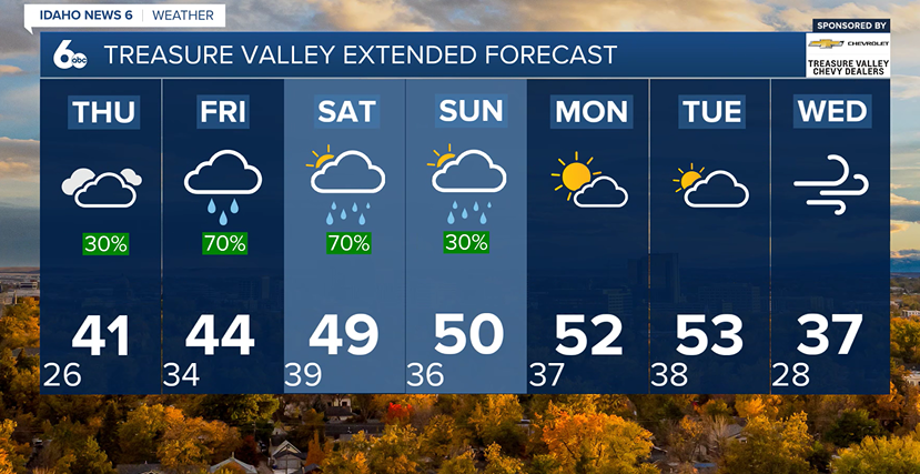
Light rain and snow develop on Thursday, with snow levels starting low enough for a brief mix or light snow in the valleys. Because precipitation will be light and daytime temperatures stay mild, valley accumulations are expected to stay under one inch.
By Thursday night into Friday, the focus shifts to the mountains. As moisture increases, steady mountain snow develops, but warming air will cause snow levels to rise on Friday, changing some lower mountain valleys over to rain. This means snow totals will vary sharply by elevation. Locations just below the snow line may see only a couple inches, while areas above 6,000 feet can pick up 5 to 10 inches of snow.
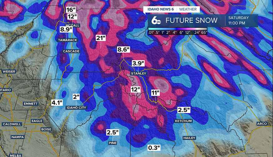
Rain totals in the valleys stay light, while the mountains receive more widespread moisture.
Looking ahead to the weekend, an active pattern continues with periodic rain and mountain snow, especially Saturday. Snow levels stay high, so most lower elevations see rain. Monday looks drier, with another system possible by Tuesday. Temperatures remain mild — running 10 to 15 degrees above normal with breezy conditions at times.