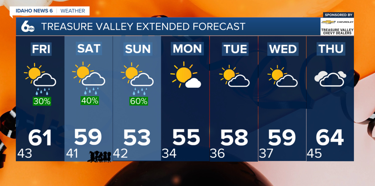
Thursday will bring one more day dry and seasonable weather across southwest Idaho before a more active weather pattern arrives for the Halloween weekend. Afternoon temperatures will climb to around 60 degrees in the Treasure Valley. High clouds will gradually increase throughout the day, but most locations will remain dry.
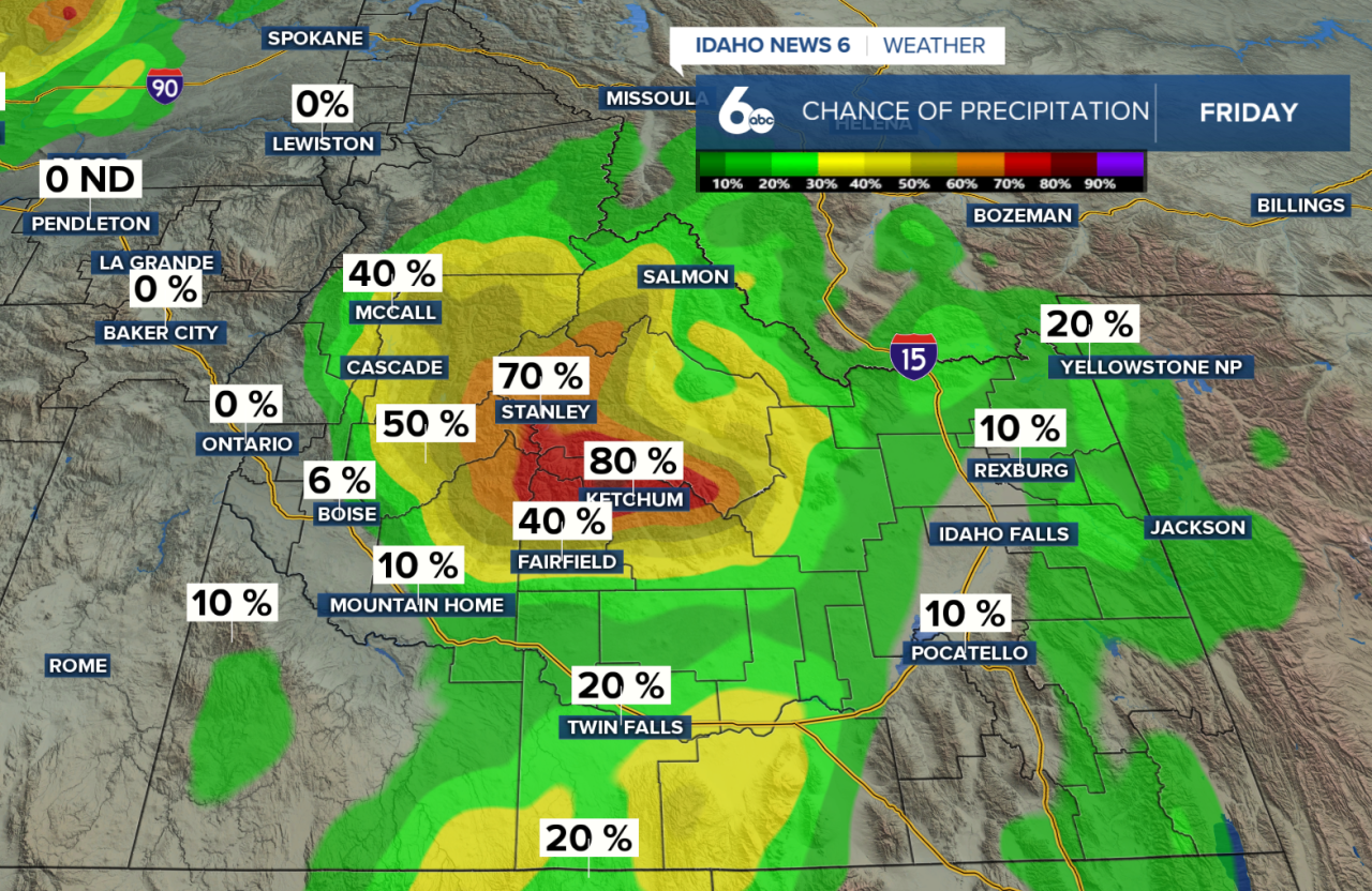
Rain chances begin increasing Friday, especially across higher elevations and portions of south-central Idaho. Isolated to scattered showers are possible throughout the day, with a brief break in precipitation expected Friday night for most areas. However, the bigger weather system will arrive Saturday, just in time for Halloween festivities.
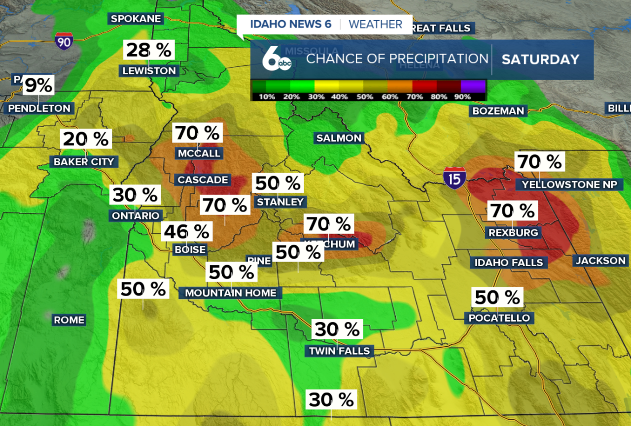
Halloween Saturday is shaping up to be the wettest day of the weekend. A Pacific storm system will bring widespread moisture into southwest Idaho, with rain chances increasing throughout the afternoon. The greatest coverage of rain is expected Saturday evening and overnight, with a 60–90% chance of precipitation across the region. If you're planning to head out trick-or-treating, rain gear and an umbrella will be good additions to your costume!
Rainfall totals from Saturday evening through Sunday could reach 0.20–0.50 inches across lower elevations and southern mountains, with higher amounts of 0.50–1 inch possible in the northern mountains. Eastern Oregon will generally see lighter rainfall totals ranging from a few hundredths to around 0.20 inches.
Mountain snow will also return, but significant accumulation is unlikely for most elevations. Snow levels will initially remain elevated between 6,500 and 8,500 feet, keeping most precipitation in the form of rain. Higher mountain elevations above 6,500 feet could pick up a dusting to a few inches of snow, while the highest peaks of the Sawtooths may see several inches.
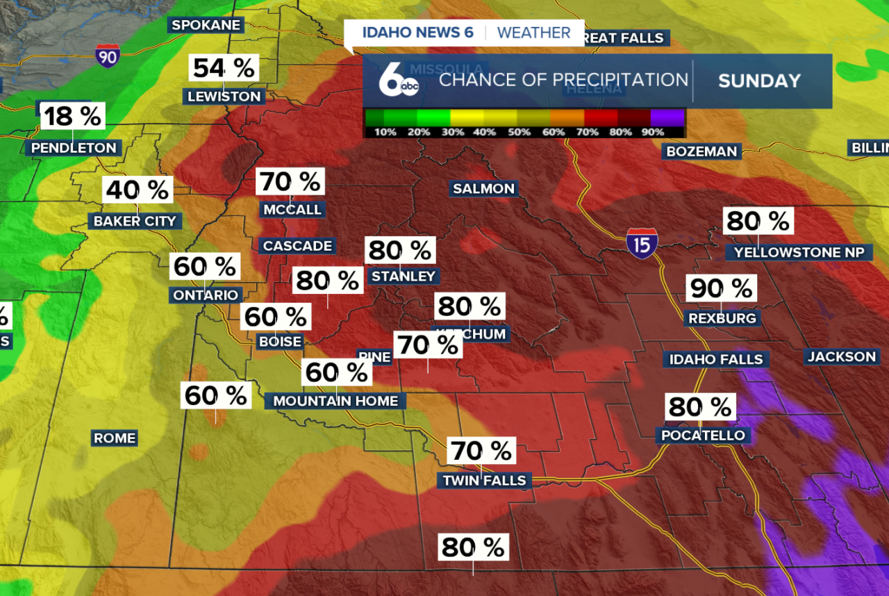
By Sunday, a cold front will push through the region, gradually bringing an end to the widespread rain. Snow levels will drop as colder air arrives, potentially allowing a rain-snow mix at elevations as low as 4,500 feet in eastern Oregon. However, precipitation will already be decreasing, limiting additional snowfall. Behind the front, gusty west to northwest winds of 20–40 mph are expected Sunday afternoon and evening, especially across the Snake River Plain.
The good news is that the unsettled weather won't stick around for long! High pressure will help bring a drying and gradual warming trend beginning Monday and continuing through at least Thursday. Temperatures will remain near seasonal averages, with occasional passing clouds but little opportunity for additional precipitation.
Either way, enjoy the dry weather Thursday, prepare for scattered showers Friday, and keep the rain gear handy for Halloween evening. Sunday will bring lingering showers and gusty winds before a quieter, drier stretch returns next week.