


Good Morning everyone
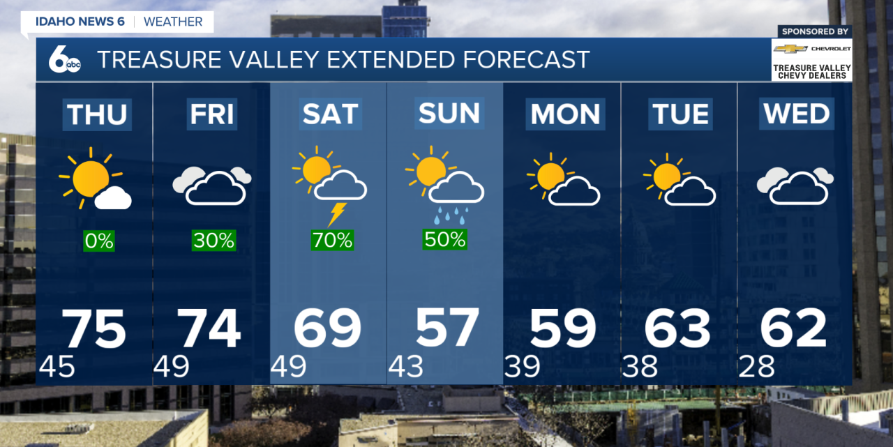
No big changes in the forecast for today, but highs are a few degrees cooler this afternoon, thanks to Tuesday's cold front. Valley floors will sit near the lower 70s again, with mountains in the mid-50s to 60s.

SW Idaho and SE Oregon will stay mostly dry with above normal temperatures through Friday, but changes are on the way as an unsettled weather pattern builds in.
A low-pressure system off the West Coast will slowly move inland throughout the workweek, bringing moisture into the region. For today and Thursday, the best chance for isolated showers and thunderstorms will stay focused over southeast Oregon and near the Idaho-Nevada border. Most other areas will remain dry and warm, with temperatures climbing 10 to 15 degrees above normal by Thursday and Friday.
By Friday afternoon, storm chances increase as the system moves onshore. Showers and thunderstorms are expected to become more widespread across southeast Oregon and southwest Idaho. Some of those storms could turn stronger Friday into the weekend, bringing gusty winds, small hail, and brief heavy rain.
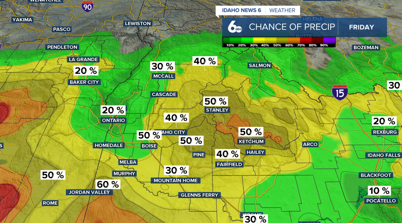
Rainfall totals through Friday night could reach up to a half inch in Harney and Malheur counties, with as much as an inch possible over Steens Mountain.
The unsettled pattern continues through the weekend and into early next week as another low-pressure system quickly follows behind the first. Widespread precipitation is expected from Saturday through Monday, with the greatest concern on Saturday afternoon when stronger thunderstorms may develop again. A few storms could become severe, mainly producing strong winds along with small hail and heavy downpours.
By early next week, colder air will begin to move in. Snow levels are expected to fall from 6,000 to 7,000 feet on Sunday to around 4,000 to 5,000 feet on Monday night into Tuesday morning. Some mountain valleys could pick up light snowfall, while higher peaks may see localized totals up to 6 inches.
For travelers and anyone with outdoor plans, the biggest impacts will be the return of thunderstorms Friday through Sunday, along with periods of heavier rain, gusty winds, and changing mountain conditions by early next week.
Forecast: A cool and quiet Wednesday ahead of weekend storms
Treasure Valley Extended Forecast
McCall Forecast
