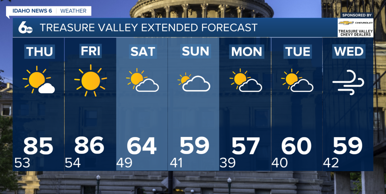
Very warm and dry weather will stick around through the end of the workweek, but a major pattern change arrives this weekend, bringing much cooler temperatures and increasing chances for rain and even some high-elevation snow.
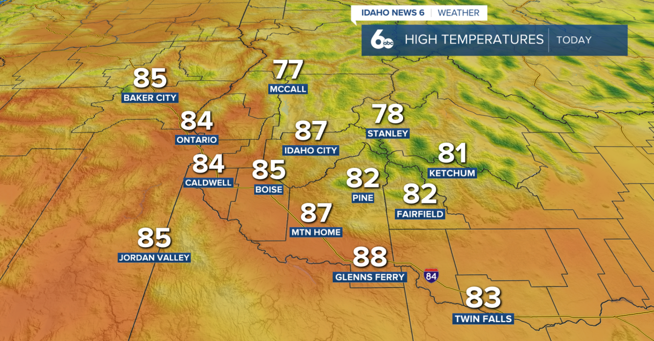
High pressure will remain in control through Friday, keeping temperatures well above normal. Highs across the lower valleys will climb into the low to mid 80s, putting some locations near daily records. Skies will stay mostly clear through Thursday with generally light winds. Overnight temperatures will fall into the 40s and lower 50s, with some colder mountain valleys dropping into the 30s.
Changes begin Friday as a cooler weather system approaches from the northwest. Winds will pick up during the day, with gusts around 25 to 35 mph possible across higher terrain, southeast Oregon and far southwest Idaho. Lower elevations could see gusts closer to 15 to 25 mph.
A cold front moves through Friday night, opening the door to a dramatically cooler weekend. High temperatures Saturday could be 15 to 25 degrees colder than Friday, with breezy conditions continuing across the region.
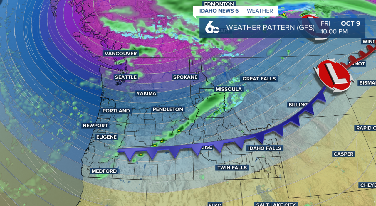
The approaching system will also bring increasing chances for showers this weekend. Rain chances will be highest across Idaho, with some snow possible in the higher mountains. Snow levels could fall to roughly 4,500 to 6,000 feet in southeast Oregon and 5,500 to 7,500 feet across southwest Idaho.
Even cooler air settles in Sunday, with afternoon temperatures expected to run around 5 to 10 degrees below normal.
The forecast becomes more uncertain late Sunday into early next week. The storm system is expected to move south toward California, where it could interact with tropical moisture associated with the remnants of Hurricane Rachel. Some of that moisture could reach southern Idaho and potentially produce heavy rainfall.
Exactly how much rain reaches our area will depend heavily on the track of the storm. A farther south track would keep most of the deeper moisture away, while a farther north track could bring considerably more precipitation into Idaho. Forecast confidence remains low this far out, so rainfall amounts will become clearer over the next several days.
Cool and unsettled conditions could linger through Tuesday before temperatures gradually return closer to normal by Wednesday. Frost may also become possible in some lower valleys next week, especially if skies clear and drier conditions develop.