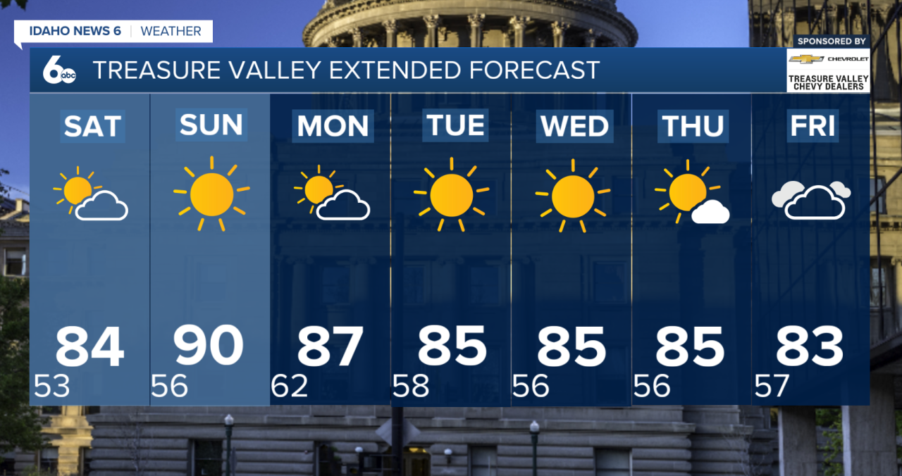
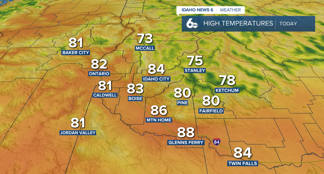
Friday starts off dry and mild across southwest Idaho as high pressure continues to strengthen over the region. Expect a mix of sunshine and high clouds today, with temperatures quickly warming through the afternoon. Highs across the lower valleys will climb into the low to mid 80s, running around 10 to 15 degrees above normal for early October. Winds will remain light, making for a warm and quiet end to the workweek.
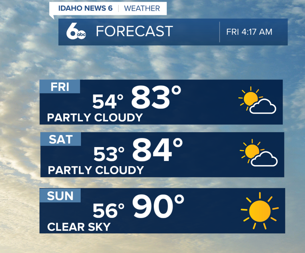
Even warmer weather is on the way this weekend. Mostly clear skies are expected Saturday and Sunday as high pressure reaches peak strength. Temperatures will climb a few degrees each day, with Sunday shaping up to be the warmest day of the stretch.
Boise is forecast to reach 89 degrees Sunday, which would challenge the daily record high of 88 degrees. There is also a 40% chance Boise reaches 90 degrees. If that happens, it would mark the first 90-degree October day in Boise since 2015.
A weak disturbance will move through Monday, knocking temperatures down a few degrees. Most locations will remain dry, although there is a 5 to 10% chance of showers or thunderstorms over the higher terrain near the Nevada border and across central Idaho.
High pressure quickly rebuilds Tuesday through Thursday, keeping sunshine, dry conditions and well-above-normal temperatures in the forecast.
Changes may arrive next weekend as another system approaches the Pacific Northwest. Cooler temperatures and precipitation could eventually follow, but confidence remains low on the exact timing. Forecast models are also hinting at the possibility of tropical moisture moving into parts of the West, although it is still too early to determine whether that would have any impact on our area.